Viewable maps, Iewable – Ag Leader InSight Ver.8.0 Users Manual User Manual
Page 319
305
H
ARVEST
AutoSwath is particularly useful when harvesting point rows and other areas where harvesting a full
head width is not possible. As the combine travels beyond a harvested area, the AutoSwath feature
automatically changes the active head width by the use of a "stair-step" method, in which the width is
reduced by successive amounts.
Select the AutoSwath Checkbox
Bottom of Run screen
To enable the AutoSwath feature, select the
AutoSwath checkbox, located at the bottom left-
hand side of the Run screen, above the tabs.
Note: The master button must be set on AUTO (not OFF) for the AutoSwath feature to function.
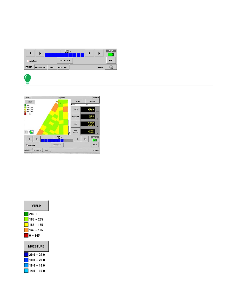
AutoSwath on Run Screen
AutoSwath in operation
Now that you have selected the AutoSwath checkbox, the
blue indicator bar and the percentage amount above the bar
both show what percentage of your original swath width is
now being logged into the display.
Each box on the blue indicator bar corresponds to a specific
section width on your combine head. In the example shown
at left, the first three sections on the right have stopped
logging data to the display. The section width represented by
the blue indicator bar was automatically configured for you
when you created the configuration on your combine.
At times, however, this section width may change if you
make adjustments to the AutoSwath's sensitivity settings, which are set specific to your combination of
Vehicle and Head. These sensitivity levels compensate for varying degrees of GPS performance. For
more information, see the AutoSwath Sensitivity Settings page in this section.
V
IEWABLE
M
APS
There are three different types of viewable maps in harvest. The maps are accessed by pressing the
button in the legend that is either labeled yield, moisture, or variety.
The yield map displays an on the go color yield map. To edit the legend, see
.
The moisture map displays an on the go color moisture map. To edit the legend, see