Interact with geospatial pdfs, Find map locations – Adobe Acrobat 9 PRO Extended User Manual
Page 414
408
USING ACROBAT 9 PRO EXTENDED
3D models and geospatial PDFs
Last updated 9/30/2011
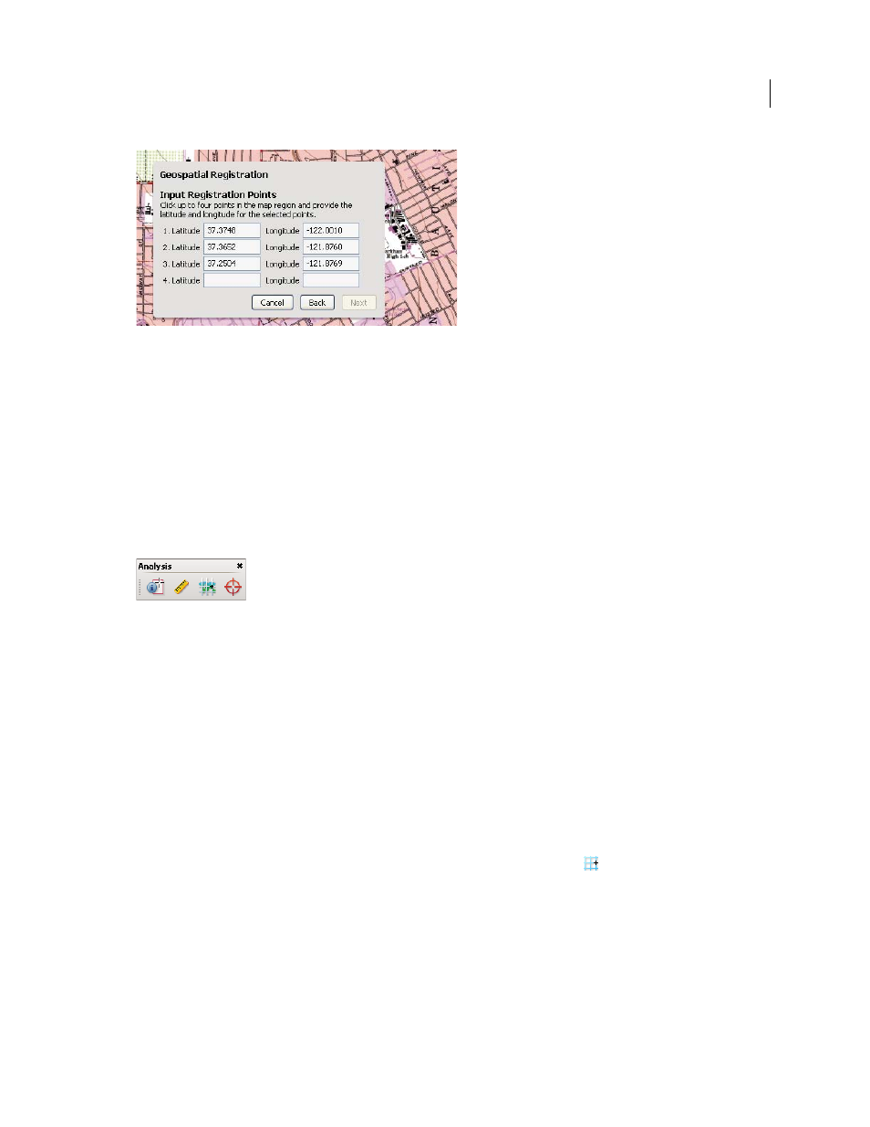
Input latitude and longitude values of the map borders.
The coordinates define the area that is registered.
5 Click in at least two remaining corners, and type the latitude and longitude coordinates for each. Then click Next.
6 Select the associated coordinate system and units (projection scale) to associate with the map and click OK.
Interact with geospatial PDFs
When you open a geospatially enabled PDF, you can find locations, measure distances, and add location markers. You
can also copy coordinates to the clipboard for use with a web mapping service.
View the geospatial measuring tools by choosing Tools > Analysis > Show Analysis Toolbar.
Geospatial tools on the Analysis toolbar.
Use the Geospatial Location tool to perform these tasks:
•
View latitude and longitude while the cursor is over an area containing geospatial information.
•
Mark a location with a geospatial annotation.
•
Search for a location in a document.
More Help topics
Commenting and markup tools overview
Measure the height, width, or area of objects
Find map locations
1 Open a geospatial PDF and choose Tools > Analysis > Geospatial Location tool
.
2 Right-click inside the map, and then click Find A Location.
3 Type the latitude and longitude values (degrees, minutes, seconds, or decimal) in the two text boxes, and click Find.
If at least one location is available, the location is highlighted with a blue square and the page is centered on the
highlighted location.