Spectra Precision FAST Survey Reference Manual User Manual
Page 269
p267
Note:
When using either GPS or total stations for slope staking, you can obtain more graphics and less screen
information by pressing the down arrow key. It literally has the effect of bringing the graphic screen down (see
below). Pressing the up arrow key will pull the screen back up and show the full text. This works in all modes
except GPS Simulation, where the up arrow moves the cursor faster, down arrow slower.
The Slope Stake Report and Writing on the Slope Stake
Surveyors doing slope staking have the option to write the information on the stake as each is surveyed, or to come back
at a later time, refer to the slope stake report, and write on all the stakes after the surveying is complete. The slope stake
report file is a comma-separated “.txt” file, configured in Job Settings, Stake, Cutsheets, which might appear as
follows if formatted in Excel or another spreadsheet form:
#Des Sta
Des Off
Des Elv
Staked Sta
Staked Off Staked Elv
Desc
1+00.000
L33.849
998.075
0+99.966
L33.453
998.075
Catch
Point
1+00.000
L38.849
------
1+00.019
L38.866
998.15
First
Offset
Point
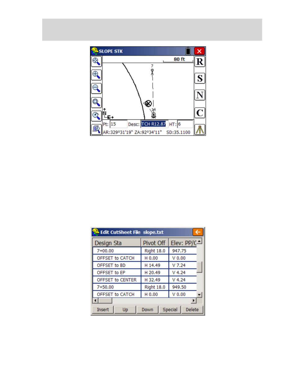
Here is another example as viewed in the Edit mode within Job Settings, Stake, Cutsheets, Edit Slope Stake.
The columns are configurable with the Slope Stake formatting in Job Settings. Shown above is a "total" report (as
opposed to "progressive"). No offset stake was set. The template involved was flat from centerline for 12', then had a
2:1 slope for 6' into a ditch point (ID="BD" for "base of ditch). This cut downslope condition was created within an
office-entered template using Carlson Civil or Carlson Roads, and FAST Survey automatically detected the cut
condition and used the ditch points as pivot points, offset 18 with elevations 945.75 at station 6+00 and 946.50 at station
6+50. Some survey teams use one person to set the slope stakes and another to enter data on the stakes, which is easily
done using the stored slope stake report above.