Pitney Bowes MapInfo Professional User Manual
Page 486
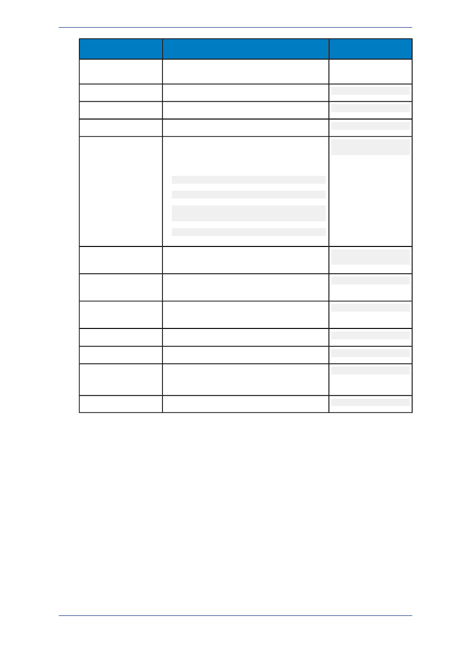
Example
Values to Assign
Column Name
COORDINATESYSTEM as defined by MapInfo
Professional.
-90
Lower left bounding Y value.
VIEW_Y_LL
360
Upper right bounding X value.
VIEW_X_UR
90
Upper right bounding Y value.
VIEW_Y_UR
Earth
Projection 1,0
A string representing a MapInfo-supported
coordinate system that specifies a map projection,
coordinate units, etc. Values are one of:
COORDINATESYSTEM
• Earth Projection 1,0 (for NAD27)
• Earth Projection 1,62 (for NAD27)
• Earth Projection 1,33 (for NAD 83)
or
• Earth Projection 1,74 (for NAD 83)
Symbol
(35,0,12)
A MapInfo Symbol clause (for a layer containing
points)
SYMBOL
NO_COLUMN
Specify the name of the column containing X
coordinates.
XCOLUMNNAME
NO_COLUMN
Specify the name of the column containing Y
coordinates.
YCOLUMNNAME
1
Specify 1 if on, 0 if off.
RENDITIONTYPE
MI_STYLE
Specify the name of the rendition column.
RENDITIONCOLUMN
left empty
Specify the name of the rendition table.
RENDITIONTABLE
This field is not used.
11
Specify the number of rows in the table.
NUMBER_ROWS
MapInfo Professional 12.5
486
Manually Making a Remote Table Mappable