Projections and their parameters, Projections, And their parameters – Pitney Bowes MapInfo Professional User Manual
Page 464
Projections and Their Parameters
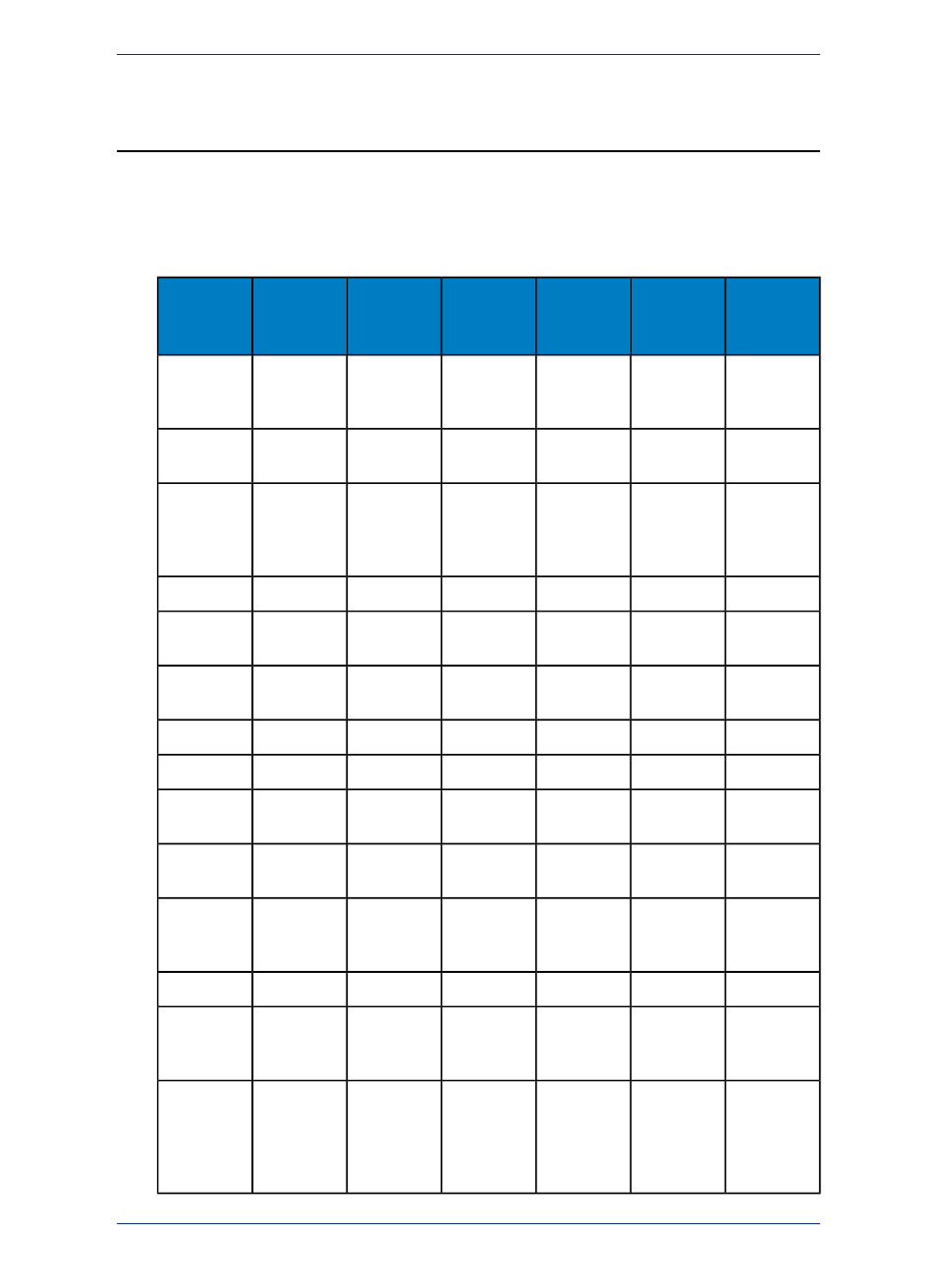
The next tables indicate the parameters applicable to each projection, which are listed in the order they
appear in the relevant coordinate system lines in the MAPINFOW.PRJ file (the first table lists the first six
parameters and the second table lists the next six parameters). The projection type is the equation or
equations used by a coordinate system. The following list names the projections MapInfo uses and gives
the number used to identify the projection in the MAPINFOW.PRJ file:
Standard
Parallel 1
Origin,
Latitude
Origin,
Longitude
Units
Datum
Projection
Type
Projection
Name
X
X
X
X
X
9
Albers
Equal-Area
Conic
X *
X
X
X
28
Azimuthal
Equidistant
X
X
X
X
5
Azimuthal
Equidistant
(polar
aspect only)
X
X
X
X
30
Cassini-Soldner
X
X
X
X
2
Cylindrical
Equal Area
X
X
X
X
31
Double
Stereographic
X
X
X
14
Eckert IV
X
X
X
15
Eckert VI
X
X
X
X
X
6
Equidistant
Conic
X
X
X
X
33
Equidistant
Cylindrical
X
X
X
X
34
Extended
Transverse
Mercator
X
X
X
17
Gall
X
X
X
X
7
Hotine
Oblique
Mercator
X
X
X
X
X
32
Krovak
Oblique
Conformal
Conic
(JTSKc)
MapInfo Professional 12.5
464
Projections and Their Parameters