Pitney Bowes MapInfo Professional User Manual
Page 315
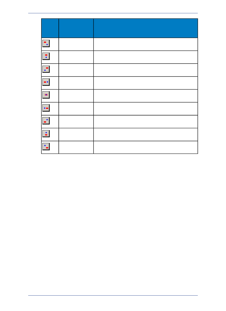
Description
Position
Anchor
Point
Button
Places the label above and to the left of the anchor point.
Upper Left
Centers the label directly above the anchor point.
Upper Center
Places the label above and to the right of the anchor point.
Upper Right
Places the label directly to the left of the anchor point.
Left
Centers the label at the anchor point.
Center
Places the label directly to the right of the anchor point.
Right
Places the label below and to the left of the anchor point.
Lower Left
Centers the label directly below the anchor point.
Lower Center
Places the label below and to the right of the anchor point.
Lower Right
The anchor point is an ongoing attribute of the label. For example, if you anchor a point object's label
at Center Left and you increase the label's font size, the text will grow to the left. This way, the text
can never overwrite the point.
• Label offset - Designate number of points (a measurement of text size) label should be placed from
the anchor point.
The label's anchor point and offset move a label with respect to its current location and the
current zoom. Whenever you want to make minor adjustments to the label's position, you
should use these two options.
Note:
Lines: These options display when the layer has line objects.
• Horizontal - Select to display all labels horizontally.
• Rotated - Select to run the label text parallel to the line segment. Using this option, a horizontal polyline
would display parallel horizontal labels and a vertical polyline would display vertical street labels.
• Curved - Select to display the label along the curve of the polyline or arc segment.
• Auto position along line - Select to find the most suitable location along a polyline, because a polyline
bends too sharply at the location where the label is to be placed. MapInfo Professional draws the label
at one of the best three positions that it finds.
• Allow rotated as fallback - Select to have curved labels that cannot be drawn fall back to being
normal labels that are rotated.
• Overhang - Use this slider bar to indicate the amount a label may extend beyond the end of a line
(such as a street) The default amount is 40%.
Regions: These options display when the layer has region objects.
• Label at centroid - Place labels relative to region centroids (center points).
315
MapInfo Professional User Guide
Chapter 12: Stylizing Your Map for Presentations and Publishing