Pitney Bowes MapInfo Professional User Manual
Page 394
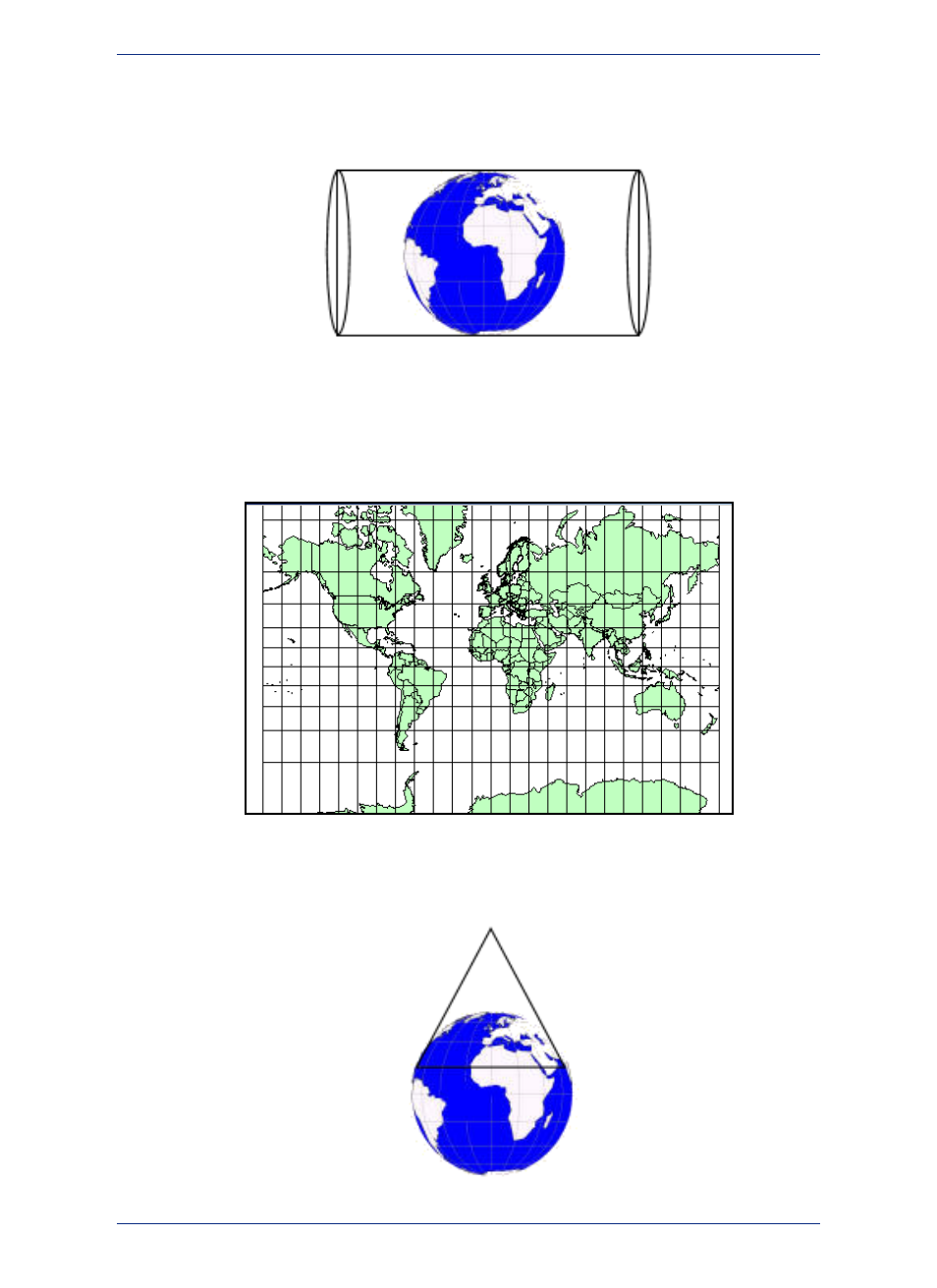
the cylinder so that it touches the Prime Meridian instead (or any line of longitude, 90 degrees away from
the Equator) you have a Transverse Projection. The closer you are to the place the cylinder touches the
globe, the more accurate the measurements are.
Globe Demonstrating the Transverse Projection
Transverse projections allow us to make maps that are more North-South line accurate, as long as you
compensate for the distance from the new "Equator" which in this case is the Prime Meridian.
Figure: Transverse Mercator Projection Map
A third type of projection attempts to resolve the distortion problem in another way. Conic projections
use a cone shape instead of a cylinder to create the "touch points" .
MapInfo Professional 12.5
394
Working with Coordinate Systems