Mapper introduction, Starting mapper, Mapper introduction -2 – TeeJet Legacy 6000 CAN Guide User Manual
Page 168: Starting mapper -2
6-2
Chapter 6 - Running Mapper
Mapper Introduction
Fieldware for the Legacy 6000
Software Version 2.11
Mapper Introduction
Mapping specific locations in a field is an important requirement in precision agriculture. The Map-
per program allows the operator to Map specific locations or more generalized areas of a field.
Once a desired location is mapped the operator can then return to that location at a later date or
use that map as a background for future use. The primary use of the Mapper program will be for
mapping specific items such as boundaries, weed patches, Insect infestation, wet areas, Tile lines,
tile risers, poles, rocks, wholes, etc. The items mapped will be stored as a .gmf file on the data
card that can be used as a background file during a Real-Time application.
The Mapper application is used without the lightbar but the data card must be inserted in the Leg-
acy 6000.
Starting Mapper
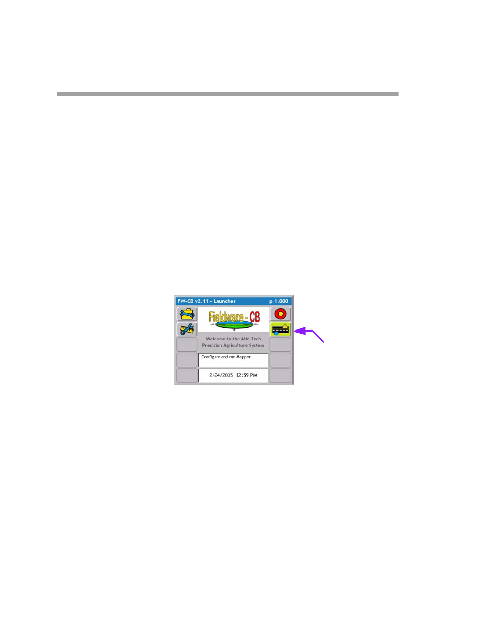
To access the mapper application select the Highway (Mapper) button from the main launcher
page. If the Mapper button is not shown on the main launcher page the PC Card option in console
setup is set to No (See “Console Setup” on page 6-8.). Once the Mapper button is selected a Job
name will be required.
Figure 6-1: The ARM Launcher Page
Roadway Mapper
soft-key