2 data acquisition – Triton Isis User Manual
Page 18
June 2004 Isis® Sonar User's Manual, Volume 1
4
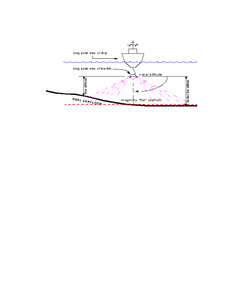
Figure 1-2. Imaginary seafloor as arbitrary reference point for sonar
altitude
Isis grew out of the Q-MIPS system and incorporates many new features;
for example it now has the ability to incorporate topographical information
from multibeam echo sounder data.
Isis now has the ability to use topographical data from multibeam echo
sounder data to correct the side-scan imagery. Isis provides a modular,
compact, low-cost alternative to Q-MIPS. As described in the following
paragraphs, Isis, following in the footsteps of Q-MIPS, offers many
improvements over previous data acquisition and imaging systems. Like
Q-MIPS, Isis actually improves the performance of the side-scan sonar and
provides a powerful interface that allows the user to manipulate and
interpret sonar imagery and subbottom data. Isis also takes full advantage
of the latest graphics cards and all of the on-board memory found there. As
a result, Isis richly displays its imagery in millions of colors.
1.2.2 Data Acquisition
A goal at Triton Elics has been to simplify the task of acquiring and storing
different data types. Along these lines, the Isis system has been designed to
acquire many of the types of data used in search and survey, both on land
and at sea.
Towfish telemetry data can be acquired by Isis via several different
interfaces. These data can be merged with the navigation and acquired via
Chapter 1: Isis Overview