Table 165: beam selection id, Table 165 – NavCom Sapphire Rev.J User Manual
Page 332
Sapphire Technical Reference Manual Rev. J
332
F9
Alt
Altitude above mean-sea-level (geoidal height) in meters
F10
M
Units for altitude (M=meters)
F11
separation
Geoidal separation (difference between the WGS-84 earth ellipsoid
and mean-sea-level, where
“-” means mean-sea-level is below
ellipsoid) in meters.
Note: If no geoid is loaded, geoidal separation is reported as 0.
F12
M
Units for geoidal separation (M=meters)
F13
age
Time since last dGPS data was received in seconds
F14
Id
4-digit integer as denoted as XXYY, where XX is the StarFire satellite
beam in use (see Table 165), and YY is the GPS correction signal
type being used (see Table 166).
F15
*CRC
Checksum
Example: $PNCTGGA,032215.00,3713.870081,N,12148.058703,W,2,08,1.8,59.608,M,
-33.440, M,8.0, 0122*47
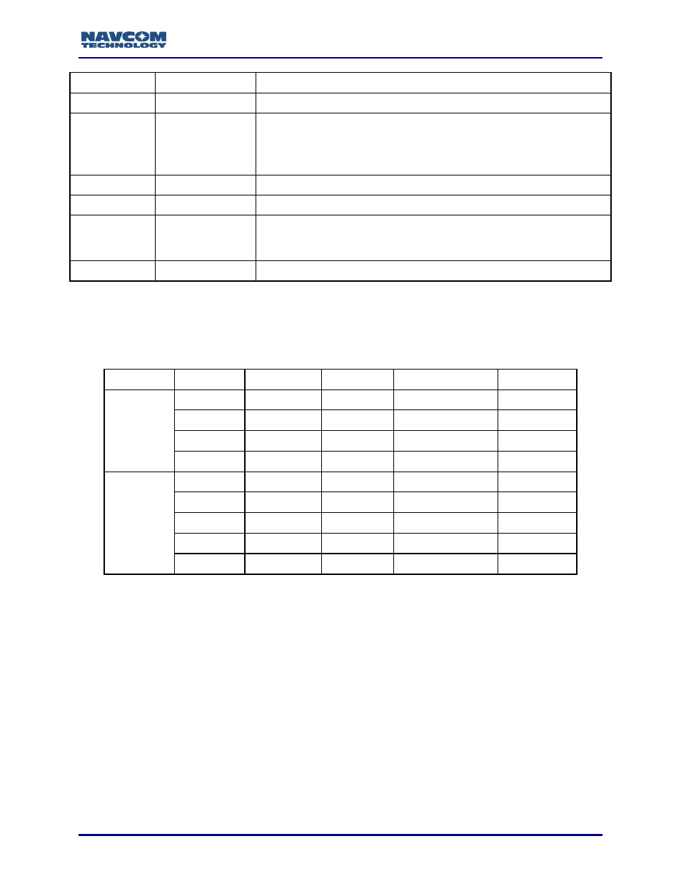
Table 165: Beam Selection ID
Network
Code (XX)
Designation
Satellite ID
Longitude
Uplink Site
Net 1
00
N/A
N/A
Unknown
Unknown
01
4F3
402
97.65W
Laurentides
02
4F2
525
25E
Burum
03
4F1
643
143.5E
Auckland
Net 2
04
3F3
678
178E
Santa Paula
05
3F4
446
54W
Southbury
06
3F1
564
64E
Perth
07
3F2
484
15.5W
Southbury
09
N/A
N/A
Manual Override
Satellites 609 and 643 have been reassigned to provide improved reception.
Satellite 609, which was in Net1, is now in Net2, and satellite 643, which was in
Net2, is now in Net1.