Measure remote point, Remote height measure remote point – Leica Geosystems TPS1100 Professional Series - Reference Manual User Manual
Page 81
81
TPS1100 - Appl. Prog. Ref. Manual 2.2.0en
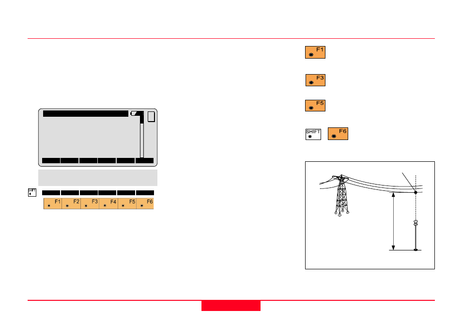
Remote Height
Measure Remote Point
Once the base point has been
measured, this dialog shows the
position of the point - above or below
the base point - aimed with the
telescope. The data are immediately
updated while turning the instrument.
V
Vertical angle to the remote point.
Slope Dist.
Slope distance from the instrument
station to the remote point.
(calculated)
∆∆∆∆∆
Ht. Diff.
Height difference between the remote
point and the base point ground.
East
Calculated Easting for the remote
point.
North
Calculated Northing for the remote
point.
Elevation
Calculated Elevation for the remote
point.
Point Id
The point number of the remote
point.
Hz
Horizontal direction from the
instrument to the remote point.
Return to the "Measure Base
Point" dialog.
Record the measurement in
the measurement job.
Enter the target data.
(see User Manual)
Exit the program.
REMHT\
Meas Remote Pt
Point Id
:
Station12
Hz
:
16°55’50’’
V
:
91°16’20’’
Slope Dist:
23.345 m
∆∆∆∆∆
Ht Diff. :
6.435 m
East
:
3453.998 m
BASE
STORE
TARGT
MC
North
:
124.003 m
Elevation :
768.005 m
1
100pr15
Base
Point
Remote Point
∆
Ht. Dif
f