Orthogonal, Stakeout – Leica Geosystems TPS1100 Professional Series - Reference Manual User Manual
Page 40
40
TPS1100 - Appl. Prog. Ref. Manual 2.2.0en
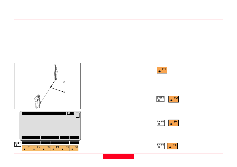
Stakeout
Orthogonal
Setting out values are computed as
orthogonal coordinates to the
baseline between instrument station
and prism. If the elevation is also
known,
∆
H is given in relation to the
last prism - point measured.
Note, data will be displayed if there is
at least one point measured.
Point Id
Number of the point to be staked.
Azimuth
Azimuth from the station to the point
to be staked.
Hz
Present theodolite direction. Note, if
the instrument is oriented and the
azimuth and Hz angle are
corresponding, the instrument is
pointing to the point to be staked.
∆∆∆∆∆
Length and
∆∆∆∆∆
Cross in relation to
the baseline: last stakeout point -
instrument station.
∆∆∆∆∆
Length
In-line distance
∆∆∆∆∆
Length is positive
for points further than the last prism
position measured.
∆∆∆∆∆
Cross
Distance perpendicular to the
baseline.
∆∆∆∆∆
Cross is positive for
points on the right of the baseline.
∆
∆
∆
∆
∆
Height
Height difference from the last point
measured.
Proceed to "STAKEOUT".
Motorized theodolites can
drive the telescope to the horizontal
and vertical direction of the point to
be placed.
Change stakeout
method.
For more information refer to
chapter
"Select Stakeout Method".
Generate a plot of the
stakeout data.
For more information on
chapter
"Plot".
Exit the program.
STAKE\ Orthogonal Stake
Point Id
:
12
Azimuth
:
90°10'02''
Hz
:
98°34'45''
∆∆∆∆∆
Length
:
4.105 m
∆∆∆∆∆
Cross
:
1.250 m
∆∆∆∆∆
Height
:
0.340 m
STAKE
MC
METHD
PLOT
∆
Length –
1
100pr10
12
11
∆
Cross+