Road+ slope staking, continued – Leica Geosystems TPS1100 Professional Series - Reference Manual User Manual
Page 225
225
TPS1100 - Appl. Prog. Ref. Manual 2.2.0en
Road+
Slope Staking, continued
Before proceeding, move the cursor
to the "Template" option.
Choose the template to use for
slope staking. If the displayed
template is the correct one, then it
will not be necessary to change it.
Start the slope stake
program.
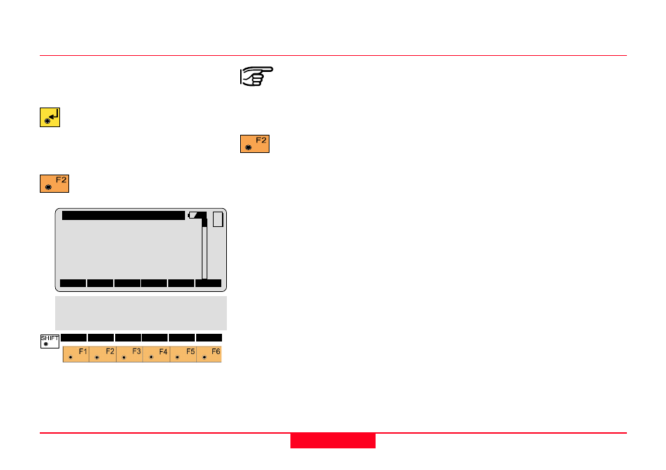
Road+\
Slope Staking
Station
:
2.000
Cross Sect:
+00OFFICE
Xsection
:
CUT
∆∆∆∆∆
CL Offset:
-0.409 m
∆∆∆∆∆
XS HgtDif:
+1.188 m
∆∆∆∆∆
Station
:
-0.037 m
MC
ALL
DIST
REC
CONT
FILLS
∆∆∆∆∆
ST=0 STORE I<>II REFPT QUIT
∆∆∆∆∆
HingeOffs:
-0.209 m
∆∆∆∆∆
HinteHgtD:
-0.979 m
Elevation :
401.612 m
The "STORE" and
"REFPT" options are not
available until after a distance is
measured.
Measure to the current
position of the prism pole.
When the value of "
∆
XS Hgt Diff" and
"
∆
Station" are zero, or close to it, the
prism pole is at the catch point.
In the sample display shown, the
value for "
∆
XS Hgt Diff" is 1.188m.
The value is positive, meaning the
measurement was taken at a point
that is above the cut slope. Assuming
the cut slope is 1:1, the rodperson
will want to move approximately 1
meter away from the centerline
before making the next
measurement.
The value of the
∆
Station is -0.037m.
The value is negative, meaning the
measurement was taken at a point
whose station is slightly lower than
the indended 2.000. The rodperson
will want to move slightly up station
before making the next
measurement.