Traverse, Introduction – Leica Geosystems TPS1100 Professional Series - Reference Manual User Manual
Page 124
124
TPS1100 - Appl. Prog. Ref. Manual 2.2.0en
Traverse
Traverse
Introduction
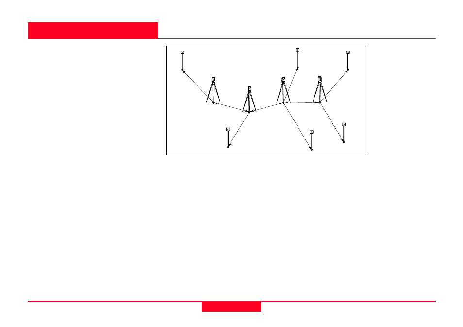
This manual describes the "Traverse"
program of the TPS1100
Professional Series instruments.
Using data about direction and
distance, the program continuously
computes the coordinates of the
station (in the example shown above,
the instrument "moves" from one
station to the next, previously
measured point) and aligns the
horizontal circle.
For a point whose coordinates are
known, the deviation from the
coordinates determined by
measurement can be computed and
displayed.
Individual stations can be calculated
as "sideshots" (SP). The coordinates
and directions of these points are
also determined in the course of this
program.
If the program is terminated (e.g. to
record a detail point), the values
remain stored. The measurement
procedure can be resumed after
calling up the program again.
1
100pr61
Backsight
Stn1
Pt2
Pt3
Pt4
SP3
SP1
SP2
SP4
Last
Point
There is no adjustment of these
differences in coordinates and
direction. Subsequently, however, the
measurements stored on the
PCMCIA can be processed with the
assistance of an appropriate software
program.