Leica Geosystems TPS1100 Professional Series - Reference Manual User Manual
Page 177
177
TPS1100 - Appl. Prog. Ref. Manual 2.2.0en
Road+ File Editor
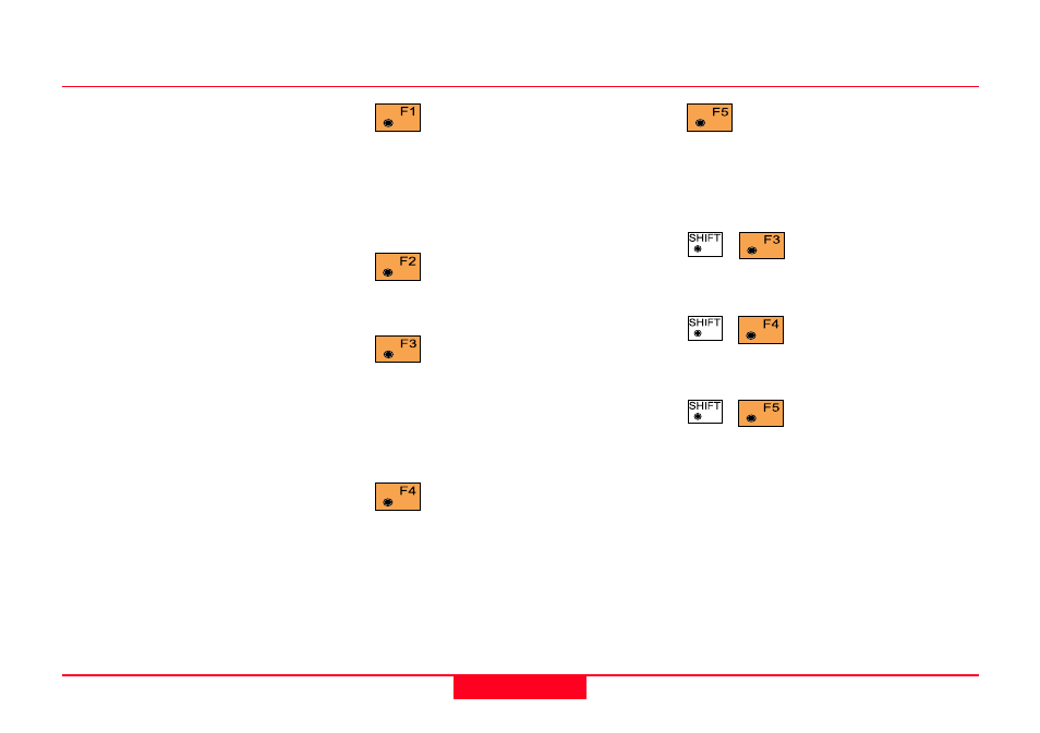
Press this key when you have
completed the edits of the
current record and are ready to insert
a new record. New records will
always be inserted at the end of a
Coordinate Data File.
Press this key when you have
completed all edits in the
current file.
Press this key to display the
record before the currently
displayed record in this file. This key
label will not be displayed if the
current record is the first record in
the file.
Press this key to display the
record after the currently
displayed record in this file. This key
label will not be displayed if the
current record is the last record in the
file.
Point Id
You may edit the Point Identifier
offered here, or press Enter to accept
it and move to the next input field.
This is the only field that may be
edited in existing records.
East
The Easting or X ordinate of the
station you wish to create. You may
edit this value only when creating a
new station.
North
The Northing or Y ordinate of the
station you wish to crate. You may
edit this value only when creating a
new station.
Elev
The Elevation or Z ordinate of the
station you wish to create. You may
edit this value only when creating a
new station.
Insert Station Coordinates, continued
Press this key to import the
coordinates of a point in this
or another file. This key label will not
be displayed if the current record is a
Code record.
Press this key
combination to display
the first record in this file.
Press this key
combination to display
the last record in this file.
Press this key
combination to search
for a particular record in this file. (
Go
to Dialog "Search")