Plot, Orientation and height transfer – Leica Geosystems TPS1100 Professional Series - Reference Manual User Manual
Page 17
17
TPS1100 - Appl. Prog. Ref. Manual 2.2.0en
Orientation and Height Transfer
Recalculate the result.
Scroll to the measurements
of the previous point.
Scroll to the measurements
of the following point.
Measure more points. Return
to the dialog "Target Point".
Delete a point from the set of
measurements. You can now
measure a new point in its place.
Return to the results dialog
without changes.
Exit the program.
∆∆∆∆∆
Hz.
Difference between calculated and
measured horizontal angle
∆∆∆∆∆
Distance
Difference between calculated and
measured distance
∆∆∆∆∆
Height
Difference between calculated and
measured height
Refl. Ht.:
Reflector height used for
the target point
Easting, Northing, Elevation:
Target coordinates used
Refl. Ht.
Reflector height used for the target
point
East, North, Elevation
Target coordinates used.
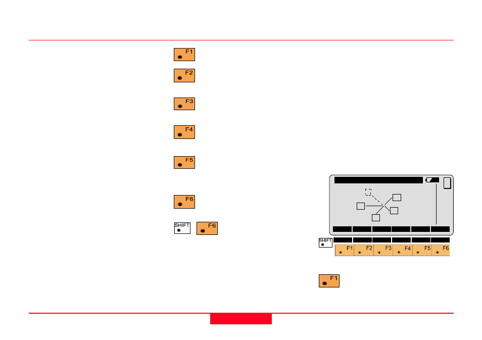
Plot
Generates a plot showing the
measurement configuration.
The station point is in the center and
the top of the sketch shows the
direction of grid north. The sketch is
true in angular but not true in
distances.
Points are numbered sequentially in
the order in witch they were
measured.
Points not used in the calculation are
marked with a dotted line.
Recalculate the result and
return to the dialog
"CALCULATION RESULTS".
More Information, continued
Ori\
PLOT
RECLC
MEAS
MC
QUIT
3
4
1
5
2