Traverse results, Cogo – Leica Geosystems TPS1100 Professional Series - Reference Manual User Manual
Page 150
150
TPS1100 - Appl. Prog. Ref. Manual 2.2.0en
COGO
Determining the distance by
means of the function "Polar
calculation"
(refer to chapter
"Inverse").
INPUT Entering horizontal
distance
RCALL Call up of a
distance which has been previously
stored using the function "Polar
calculation".
Changing the distance
(refer to dialog "Modify
Distance").
Exit the program.
Horiz.Dist.
Display of entered horizontal distance
Multiply
Entering multiplication factor
Divide
Entering division factor
Add
Entering distance for a positive
correction
Subtract
Entering distance for a negative
correction
Horiz.Dist.
Display of corrected horizontal
distance
Accept displayed values and proceed
to
dialog "TRAVERSE RESULTS".
Traverse results
The following dialog box shows the
result of the traverse:
Point Id
Entering point number of the point to
be accepted
East
Display of east coordinate
North
Display of north coordinate
Elevation
Entering height (optional)
Defining horizontal distance, continued
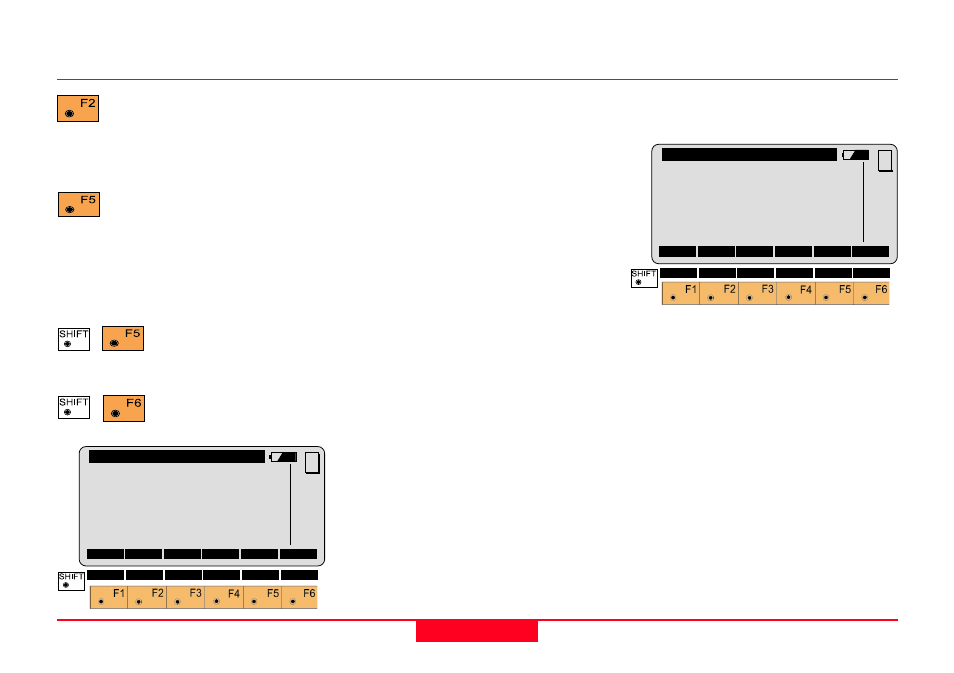
COGO\
MODIFY DISTANCE
Horiz.Dist:
0.000 m
Multiply
:
-----
Divide
:
-----
Add
:
0.000 m
Subtract
:
0.000 m
Horiz.Dist:
0.000 m
CONT
MC
COGO\ Traverse Results
Point Id
:
-----
East
:
0.000 m
North
:
0.000 m
Elevation :
-----
CONT
STORE
STAKE
MC
QUIT