Select template point and offset, Road – Leica Geosystems TPS1100 Professional Series - Reference Manual User Manual
Page 216
216
TPS1100 - Appl. Prog. Ref. Manual 2.2.0en
Road+
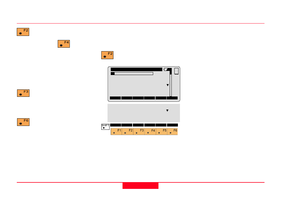
Select Template point and offset
The first step in the procedure is to
select a point on the cross section to
be staked and enter the offset.
Access the cross section
options.
Road+\
Cross Sections
1L C
Station
:
0.000
Hght.Shift:
0.000 m
Cross Sect:000000000OFFICE
∆∆∆∆∆
CL Offset:
-1.500 m
∆∆∆∆∆
CL HgtDif:
-0.030 m
MC
CONT CATCH
<-- CENTR
-->
FILLS
PLOT
QUIT
Stake Offs:
0.000 m
S.OffsetHt:
Prev. Elem
H Offset
:
0.000 m
V Offset
:
0.000 m
to make a measurement. The
normal measurement dialog
is displayed. Press
when you
are ready to calculate the station
(chainage) and offset of a measured
point. You will return to this dialog
and see the Station, Element and
Horizontal and Vertical offsets to the
measured point.
to store the results of this
measurement. (Not available
until after a measurement has been
made.
to import a point from a file,
and use it to compute the
station (chainage) and offset.
1L
Indicates the location of the cross
section point in relation to the
centerline. In this example, the "1L"
means the first point of the template
left of centerline.
C
Indicates that a cut template is
active. An F would indicate that a fill
template is active.
Chainage
Displays the current chainage.
Hght. Shift
Displays the vertical shift, if any,
applied to the whole alignment.
Template
Displays the template name being
used.
Preparing for the example, continued