Reference point, Road – Leica Geosystems TPS1100 Professional Series - Reference Manual User Manual
Page 227
227
TPS1100 - Appl. Prog. Ref. Manual 2.2.0en
Road+
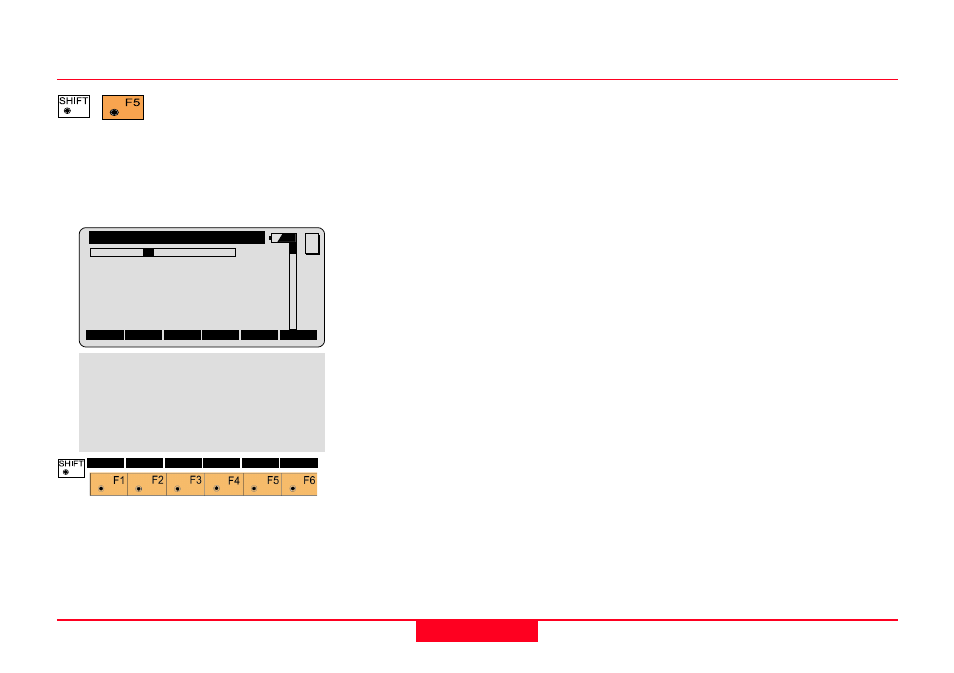
Reference Point
Displays additional
information about how
the location of the prism pole relates
to components of the cross-section.
Do this after a measurement at the
catch point has been made.
1L
Indicates the location of the cross
section point in relation to the
centerline. In this example, the "1L"
means the first point of the template
left of centerline.
Station
Displays the currently specified
station (chainage).
Cross Sect
Displays the currently specified
template name.
∆∆∆∆∆
Station
Displays difference between the
station (chainage) of the last
measurement to the rod and the
currently specified station
(chainage). Move the rod toward the
beginning of the project if this value
is positive, move the rod away from
the beginning of the project if this
value is negative.
Road+\
Reference Point
1L
Station
:
0.000
Cross Sect:
typcut
∆∆∆∆∆
Station
:
3.254 m
∆∆∆∆∆
CatchOffs:
-0.347 m
∆∆∆∆∆
CatchHgtD:
-0.389 m
MC
ALL
DIST
REC
CONT
STORE I<>II
QUIT
∆∆∆∆∆
HingeOffs:
8.154 m
∆∆∆∆∆
HingeHgtD:
-2.123 m
∆∆∆∆∆
CL Offset:
9.213 m
∆∆∆∆∆
CLHgtDiff:
-1.124 m
∆∆∆∆∆
V fmSlope:
0.014 m
Slope
:
-0.020
Elevation :
401.535 m