Stakeut from coordinate differences, Stakeout – Leica Geosystems TPS1100 Professional Series - Reference Manual User Manual
Page 47
47
TPS1100 - Appl. Prog. Ref. Manual 2.2.0en
Stakeout
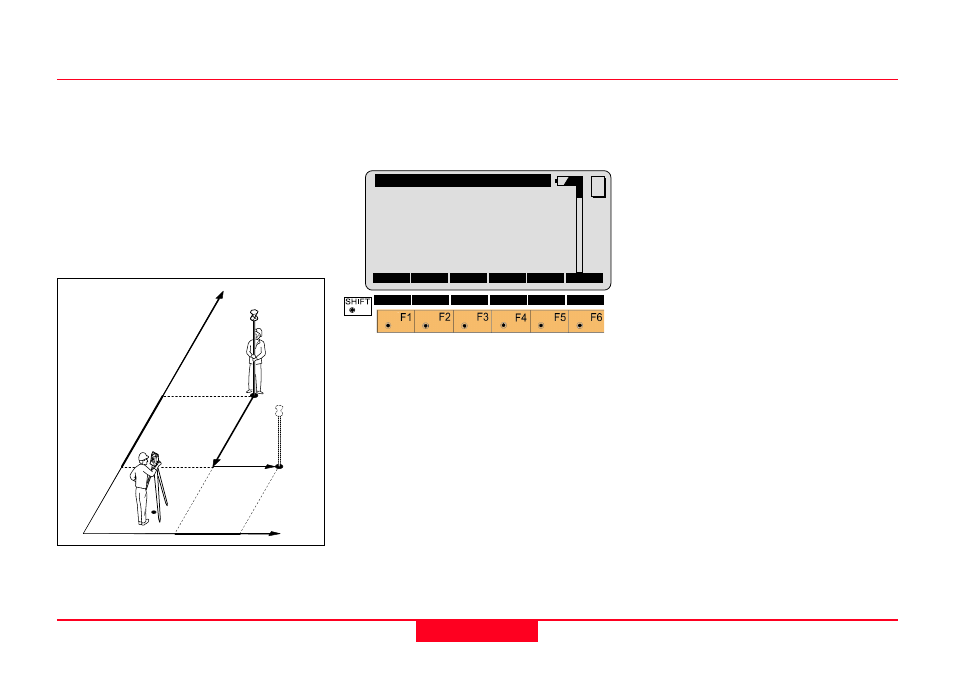
Stakeut from Coordinate Differences
After the first distance measurement,
the displacements along the grid
coordinate axes are displayed. If the
elevation of the point to be staked is
available, the height difference
between the measured reflector and
the stakeout point is shown as well
as the measured elevation of the
reflector point.
Values for
∆
East and
∆
North will be
updated each time a new distance is
measured.
STAKE\ Grid Coordinates
Point Id
:
12
Refl. Ht. :
1.65 m
∆∆∆∆∆
East
:
1.430 m
∆∆∆∆∆
North
:
-1.550 m
∆∆∆∆∆
Heigth
:FILL
0.982 m
Elevation :
0.750 m
ALL
DIST
REC
CONT
POSIT
MC
METHD
I<>II QUIT
Point Id
Point number of the point to be
staked.
Refl. Ht
Reflector height used at target point
∆∆∆∆∆
East
Displacement of the reflector along
the East-coordinate axis.
∆∆∆∆∆
North
Displacement of the reflector along
the North-coordinate axis.
∆∆∆∆∆
Height
Difference in height between the
measured reflector point and the
stakeout point. Positive in sign if
stakeout point is higher than the
reflector position.
Elevation
Elevation of the measured reflector
point.
1
100pr13
12
N
∆
North –
∆
East+
E