Remote height, Introduction, Measure base point – Leica Geosystems TPS1100 Professional Series - Reference Manual User Manual
Page 79: Introduction measure base point
79
TPS1100 - Appl. Prog. Ref. Manual 2.2.0en
Remote Height
Remote Height
Introduction
This manual describes the "Remote
Height" program of the TPS1100
Professional series.
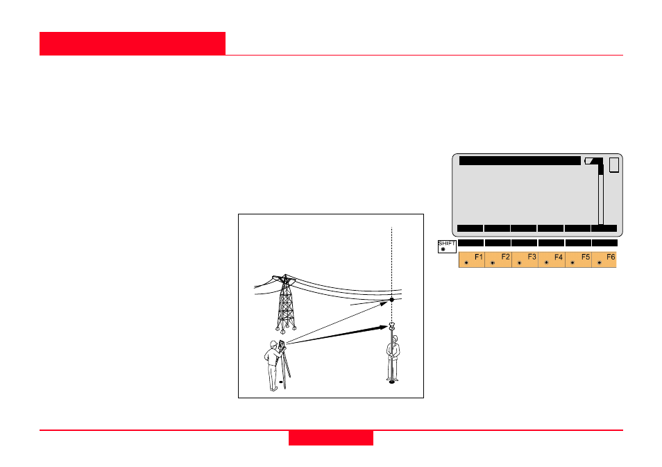
Remote Height is used to determine
the elevation of inaccessible points,
e.g. on cables or building facades.
First, the distance to a base point
situated vertically below (or above)
the remote height point must be
measured. Then you can aim to the
remote height point.
The coordinates of the remote point
are calculated from the distance
measured to the base point and from
the angles measured to the remote
point.
To ensure correct results, the target
and the reflector must be lined up
vertically. In practice it is not
generally possible to maintain an
exactly-vertical line, and so you must
decide what lateral deviation can be
tolerated.
The horizontal distance to the
inaccessible target must however
coincide with the horizontal distance
to the reflector.
When the instrument is aligned and
the station coordinates have been
set, the position coordinates of the
remote height can be calculated and
stored in the measurement job.
Measure Base Point
This dialog is used in accordance
with the settings of the system
function "Measure & Record" or
according to the dialog shown below.
Point Id
The point number of the base point.
Hz
Horizontal direction from the remote
point to the base point.
REMHT\
Meas Base Pt
Point Id
:
Station12
Hz
:
16°55’50’’
V
:
91°16’20’’
Refl. Ht. :
1.664 m
Slope Dist:
----- m
Ht. Diff. :
----- m
ALL
DIST
REC REMOT TARGT
MC
CONF
I<>II
QUIT
1
100pr14
Slope Dist.
V
ertical
alignement
Remote
Point
Base Point