Target point, Calculation, Target point calculation – Leica Geosystems TPS1100 Professional Series - Reference Manual User Manual
Page 139
139
TPS1100 - Appl. Prog. Ref. Manual 2.2.0en
Local Resection
Target Point
This dialog is similar to the
TPS1100’s basic "MEASURE MODE"
dialog. Once the measurement to the
first and to the second point is taken,
the program will proceed to the dialog
"RESULTS".
Record the measurement in
the active measurement job.
Accept the measurement.
Enter target data.
(see User Manual)
Change the theodolite
face.
Simultaneously measure and
record data in the active
measurement job.
Measure a distance.
Calculation
In this dialog the calculated station
coordinates are shown with
orientation.
Station Id
Station point number
East
Calculated E (local) for the station
North
Calculated N (local) for the station
Elevation
Calculated Elevation (local) for the
station
Ht. Diff. :
1.002 m
East
:
231.463 m
North
:
56.785 m
Elevation :
72.235 m
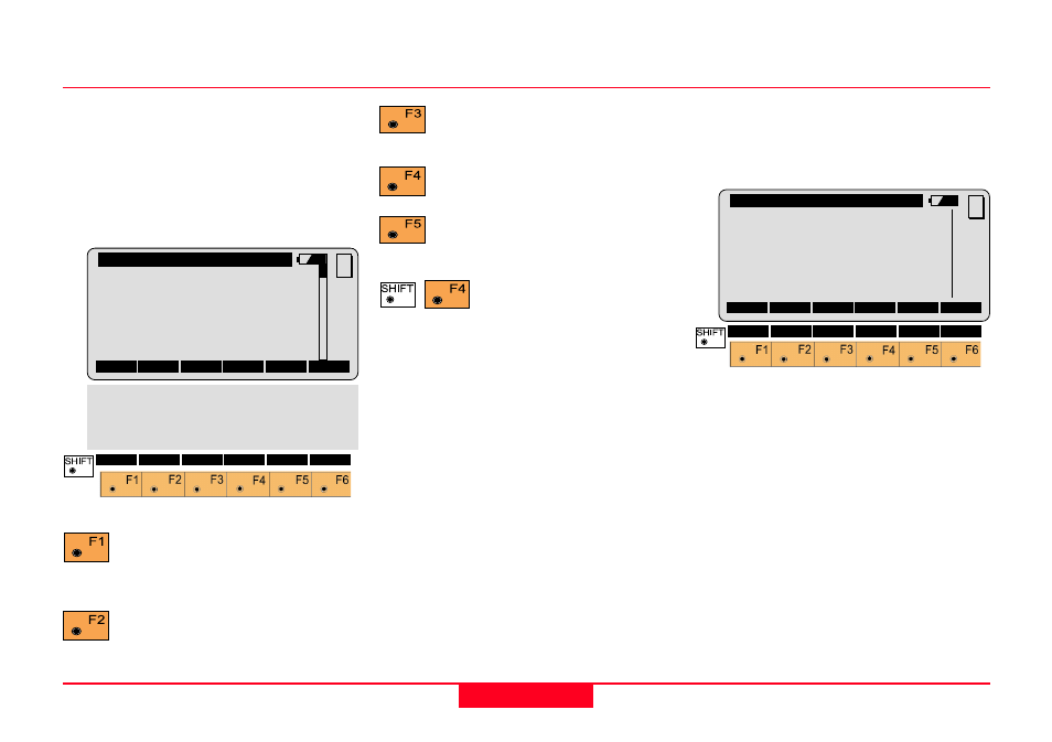
LRes\
Measure Point 1
Point Id
:
12
Point Code:
-----
Refl. Ht. :
1.300 m
Hz
:
2°10’20’’
V
:
90°19’52’’
Horiz Dist:
----- m
MC
ALL
DIST
REC
CONT TARGT
I<>II
QUIT
LRes\ Local Resec. Results
Station Id:
1
East
:
-3.369 m
North
:
0.569 m
Elevation :
0.235 m
Hz Ori.
:
135°34’56’’
SET
STORE
MC
QUIT