Road – Leica Geosystems TPS1100 Professional Series - Reference Manual User Manual
Page 221
221
TPS1100 - Appl. Prog. Ref. Manual 2.2.0en
Road+
Stakeout and Record point, continued
Set the "
∆
CL Offset" from
centerline value to positive
1.500 m. The offset value should be
positive 0.600 m, but should not
require a change because that was
the last offset value used for the
previous right side point.
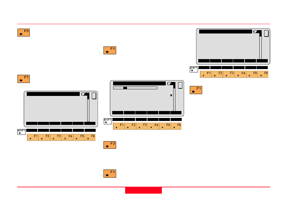
Access the "Point Coords"
display.
QUIT
Road+\ Point Coords
Station
:
25.000 m
Refl.Ht.
:
1.500 m
East
:
331.000 m
Northing
:
340.500 m
Elevation :
31.200 m
MC
STAKE
To stake the offset point on the right
side for chainage 25+00:
Activates the stakeout
program.
Record the staked out point, or
"CONT" in STAKEOUT to return to
ROAD+.
Change the "
∆
CL Offset"
from centerline to negative
1.5 m. Change the "Stake Offs."
value to negative 0.600 m.
Access the "Point Coords"
display.
QUIT
Road+\ Point Coords
Station
:
25.000 m
Refl.Ht.
:
1.500 m
East
:
331.000 m
Nort
:
340.500 m
Elevation :
31.200 m
MC
STAKE
Access the stakeout
program. (
See STAKEOUT)
Record the staked out point, or
"CONT" in STAKEOUT to return to
ROAD+.
PLOT
QUIT
Road+\ Cross Sections
1L
Station
:
25.000
Cross Sect:000000000OFFICE
∆∆∆∆∆
CL Offset:
-1.500 m
∆∆∆∆∆
CL HgtDif:
-0.030 m
Stake Offs:
0.600 m
MC
CONT
CATCH
<-- CENTR
-->
FILLS