Orientation and height transfer, Introduction, Target point – Leica Geosystems TPS1100 Professional Series - Reference Manual User Manual
Page 12: Introduction target point
12
TPS1100 - Appl. Prog. Ref. Manual 2.2.0en
Orientation and Height Transfer
Orientation and Height Transfer
This manual describes the "Orientation
and Height Transfer" program of the
TPS1100 Professional series.
Enter the target point number and
height of the reflector
Introduction
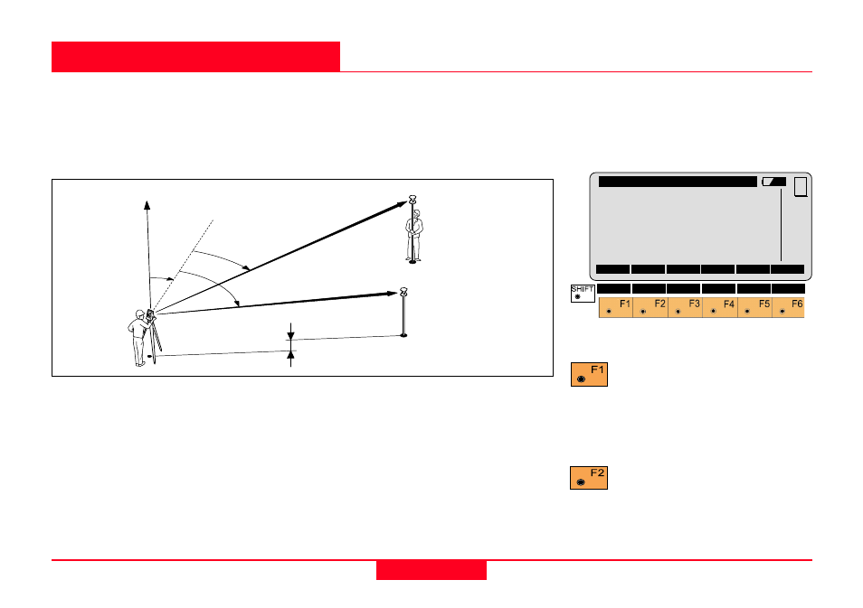
The instrument must be set up on a
known point. The program
"ORIENTATION" calculates an
angular correction for the instruments
horizontal circle, so that 0.0000 of the
horizontal circle corresponds with
grid north (Orientation correction),
using reference points with known
Easting and Northing.
For simultaneous determination of
the station elevation, height of
instrument and height of reflector
must already have been input and
the elevation of the target points
must be known. You may use target
points with elevation only.
The program handles a maximum of
10 points.
Target Point
Retrieve the coordinates of
the target point. Search the
coordinates of the point entered in
the active data job and go to the
measure mode.
Define a list of target points
and the measurement
sequence. For further use: selection
of points from the list is possible.
Ori\
Target Point
Point Id
:
12
Refl.Ht.
: 1.300
m
SEARC LIST
VIEW
MC
CONF
QUIT
1
100pr02
1st target
(E, N)
Dist1
Hz1
∆
Elev.
Hz=0
Orientation
Hz2
2nd target
(E, N, H.)
Dist2