Coordinate data files, New coordinate file, Road+ file editor – Leica Geosystems TPS1100 Professional Series - Reference Manual User Manual
Page 174: Open file, continued
174
TPS1100 - Appl. Prog. Ref. Manual 2.2.0en
Road+ File Editor
Sta. Eqn.
Refer to the chapter "Station
Equations Files", page 186, in this
manual for further details.
CRS Assignmnt
Refer to the chapter "Cross
Section Assignment Files", page
188, in this manual for further
details.
File Name:
After selecting the type of file you
wish to work with, you must select an
existing file to edit, or press "CREAT"
to create a new file of the type you
have selected.
Coordinate Data Files
New Coordinate File
You will see this dialog if you selected
File Type "Coordinate" and pressed
"CREAT" on the previous dialog. You
must specify a name for the new file.
You may specify any DOS-legal file
name. Road+ File Editor will apply
the necessary extension for you
automatically.
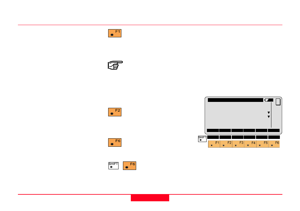
Open file, continued
Press to view and/or edit the
existing file you have
selected. The first record of the file
will be displayed.
When you see a message
that Road+ File Editor failed
to read an existing file, and that file
was created manually or with third
party software, it usually means there
is a problem with the GSI formatting
of the file.
Press to create a new file of
the type you have selected.
You will specify the name of the file
on the next dialog.
Press to see the date and
Version number of your
Road+ File Editor.
Press to Quit Road+
File Editor. This option
is available on nearly every dialog
within Road+ File Editor.
REdit\
Create File
File Type :
Coordinate
File Name :
FILE02.GSI
Decimals
:
3
CONT
MC
QUIT