Reference line, Introduction, Reference line introduction – Leica Geosystems TPS1100 Professional Series - Reference Manual User Manual
Page 66
66
TPS1100 - Appl. Prog. Ref. Manual 2.2.0en
Reference Line
Introduction
This manual describes the
"Reference Line" program of the
TPS1100 Professional series.
"REFERENCE LINE" is a specialized
form of stakeout used for
construction and building alignment.
It permits positioning of a point
referred to a line or an arc. Points for
use in the program can be measured,
entered manually, or read from the
selected measurement job.
The program records individual
measurements in the database. In
addition, the program generates a log
file containing all data for a given
measurement session.
For three dimensional positioning, the
program calculates height differences
between the target point and a
reference elevation.
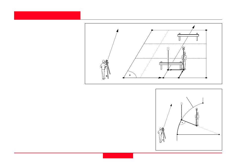
Reference Line
Depending on the configuration
settings, the reference elevation for
the reference line can be a constant
elevation or an interpolated reference
elevation. For reference arcs only
constant elevations are possible.
Points with known offsets from the
reference line or arc can be staked
out with the function "Line and
Offset".
The function is accessible from the
"Define Reference Line/Arc" dialog.
1
100pr87
1st Base Pt.
2nd Base Pt.
∆
Offset
∆
Arc
N
Reference Arc
1
100pr18
1st Base Pt.
2nd Base Pt.
Offset
∆
Offset
∆
Line
Ref. Line
Baseline
N