Stakeout and record point, Road – Leica Geosystems TPS1100 Professional Series - Reference Manual User Manual
Page 219
219
TPS1100 - Appl. Prog. Ref. Manual 2.2.0en
Road+
Stakeout and Record point
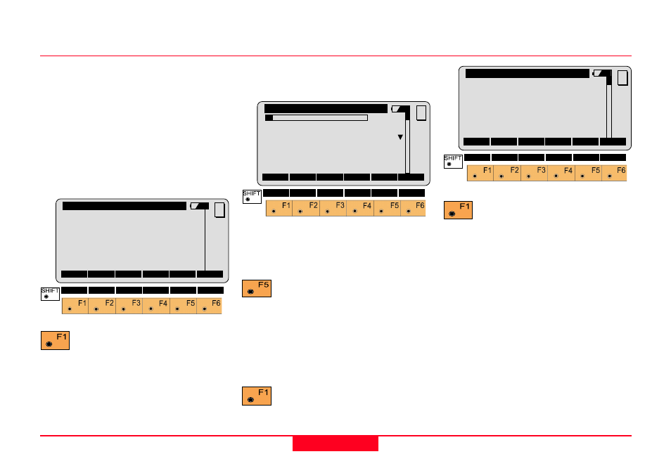
The "POINT COORDS" dialog
displays the current chainage
location of the offset point to be
staked. The display also shows the
value for the prism pole (Refl. Height)
and the Easting and Northing
coordinates of the offset point and
the finished grade elevation of the
actual point (not the offset location).
Activates the stakeout
program. (
See STAKEOUT)
Record the staked out point, or
"CONT" in STAKEOUT to return to
ROAD+.
• Stakeout Next point on Cross
Section
To set the offset stake for the right
side of our example project:
Set the "
∆
CL Offset" value to
positive 1.500 m.
Note when you do this the position
changes from "1L" to "1R". Scroll
down and highlight "Stake Offs.".
Change the offset value to positive
0.600 m.
Returns to the "POINT
COORDS" display.
QUIT
Road+\
Point Coords
Station
:
0.000 m
Refl.Ht.
:
1.500 m
East
:
331.000 m
Nort
:
335.000 m
Elevation :
31.000 m
MC
STAKE
PLOT
QUIT
Road+\ Cross Sections
1L C
Station
:
0.000
Cross Sect:000000000OFFICE
∆∆∆∆∆
CL Offset:
-1.500 m
∆∆∆∆∆
CL HgtDif:
-0.030 m
Stake Offs:
-0.600 m
MC
CONT
<-- CENTR
-->
FILLS
Stakeout the 0.600 m offset
stake for the right side of the
bike path. (
See STAKEOUT)
Record the staked out point, or
"CONT" in STAKEOUT to return to
ROAD+.
QUIT
Road+\ Point Coords
Station
:
0.000 m
Refl.Ht.
:
1.500 m
East
:
331.000 m
Nort
:
335.000 m
Elevation :
31.000 m
MC
STAKE