Distance-distance intersection, Cogo – Leica Geosystems TPS1100 Professional Series - Reference Manual User Manual
Page 157
157
TPS1100 - Appl. Prog. Ref. Manual 2.2.0en
COGO
Point Id
Entering point number of the bearing-
bearing
East
Display of east coordinate
North
Display of north coordinate
Elevation
Entering height (optional)
Bearing-Distance Intersection, continued
Return to "Intersections".
Changing between both
solutions.
The following results have
been stored in the active
measurement data file:
WI 11
Station Point Number
WI 81 Easting coordinate
WI 82 Northing coordinate
WI 83 Elevation (optional)
If "Point Id" has not been entered, the
function is not available.
Call up the program
"Stakeout".
The program "Stakeout" assumes
that the instrument is set and
oriented to a known point.
If "Point Id" has not been entered, the
function is not available.
Exit the program.
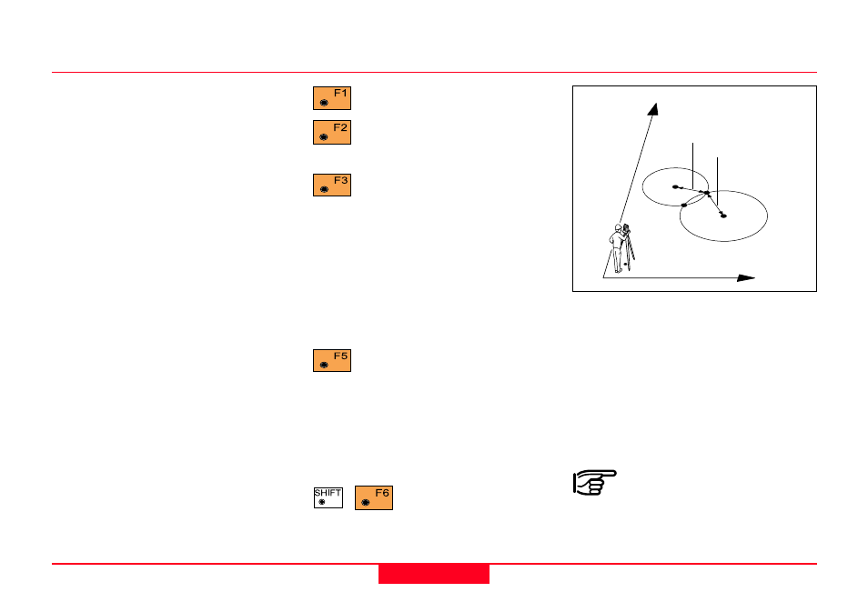
Distance-Distance Intersection
Search
• Bearing-bearing coordinates
S1 and S2 (E, N)
Given
• point 1 (E, N), radius 1
• point 2 (E, N), radius 2
Station coordinates and
orientation need to have
been set correctly before the
coordinates of point 1 and/or 2 can
be determined by measurement.
1
100pr71
N
E
2
1
Horiz.Dist. #1
Horiz.Dist. #2
I
2
I
1