Measurement and recording, Auto record measurement and recording – Leica Geosystems TPS1100 Professional Series - Reference Manual User Manual
Page 248
248
TPS1100 - Appl. Prog. Ref. Manual 2.2.0en
Auto Record
Measurement and Recording
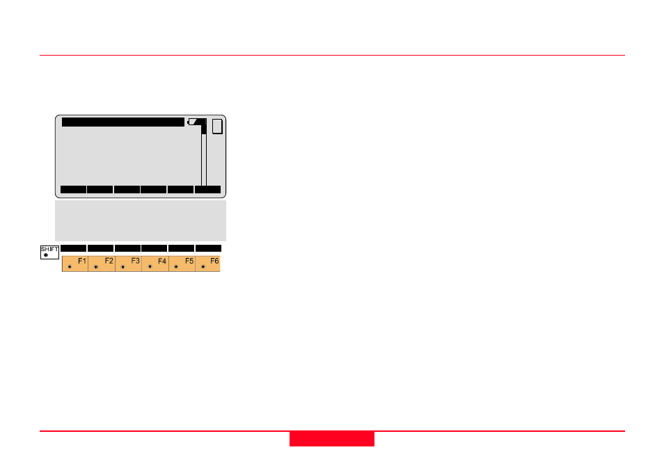
When the program starts, it will
display the AREC\ MEASUREMENT
dialog.
AREC\
Auto Record
Point Id
:
1
Point Code:
-----
Refl. Ht. :
1.500 m
Hz
:
289.3570 g
V
:
64.5875 g
Horiz Dist:
2.616 m
ALL
DIST
REC START TARGT
MC
CONF
I<>II
QUIT
QUIT
Ht. Diff. :
0.312 m
East
:
102.518 m
North
:
99.873 m
Elevation :
401.257 m
Point Id
The point identifier assigned to the
next recorded position.
Point Code
The Point Code assigned to the next
recorded position. The Point Code
may or may not be recorded,
depending on the REC Mask you
have specified.
Refl. Ht.
The current height of the prism above
the end of the plumb pole, or above
the ground if the prism is mounted on
a vehicle or other objects.
Hz
The current reading of the horizontal
circle. This will correspond with the
grid azimuth of the line of sight only if
the instrument has been oriented
before starting the Auto Record
program.
V
The current reading of the vertical
circle.
Horiz.Dist
The last unrecorded slope distance
reduced to a horizontal distance at
the elevation of the instrument.
Ht. Diff.
The ground to ground height
difference from the instrument station
to the prism at the last measured
slope distance.
East
The Easting or X coordinate at the
last measured slope distance to the
prism.
North
The Northing or Y coordinate at the
last measured slope distance to the
prism.
Elevation
The ground elevation at the last
measured slope distance to the
prism.