Calculation, Orientation and height transfer, Measure mode, continued – Leica Geosystems TPS1100 Professional Series - Reference Manual User Manual
Page 14
14
TPS1100 - Appl. Prog. Ref. Manual 2.2.0en
Orientation and Height Transfer
Simultaneously measure and
record data on the active
recording device.
Return to the dialog "Target Point".
Measure a distance.
Record the measurement on
the active recording device.
Return to the dialog "Target Point".
Accept the measurement and
return to the dialog "Target
Point".
Calculation
Calculates the orientation, the
elevation and the respective standard
deviations.
Station Id.
Point number assigned to the station
No. of Pts.
Number of points measured
Inst.Height
Instrument Height
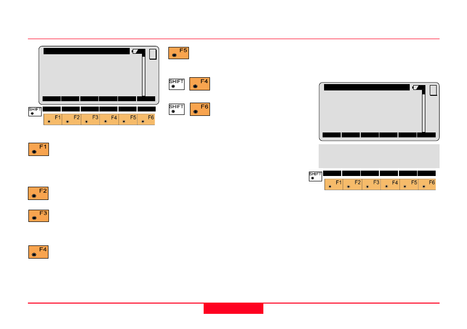
Measure mode, continued
Ori\
Measure
Point Id
:
1
HZ
:
216°55'50"
V
:
71°16'20"
Refl. Ht.
:
1.300
m
Slope Dist :
385.231
m
∆∆∆∆∆
HZ
:
-----
ALL DIST
REC
CONT TARGT
MC
I<>II
QUIT
Enter target data.
(see User Manual)
Change the theodolite
face.
Exit the program.
LSQRS
PLOT
QUIT
Hz Ori.
:
2°12'34''
σ
σ
σ
σ
σ
Elev.
:
0.010
m
σ
σ
σ
σ
σ
Hz Ori.
:
0°00'03*
Ori\ Results (Robust)
Station Id
:
10
No. of Pts. :
5
m
Inst.Ht.
:
1.635
m
East
:
2134.234
m
North
:
4723.365
m
Elevation
:
521.643
m
S.ORI S.HT STORE MEAS
MORE
MC