Define points – Leica Geosystems TPS1100 Professional Series - Reference Manual User Manual
Page 259
259
TPS1100 - Appl. Prog. Ref. Manual 2.2.0en
TQM
Continue to next point without
recording data in measurement
job.
Calculate the plane
parameters. Note: this key is
only available after two points have
been measured/input.
Import point coordinates.
Exit program.
Two points define a vertical
plane. Use more points to
define a tilted plane.
The program checks if the
plane is defined in space
(minimum distances between points)
but does not check for optimal point
distribution.
Coordinates of the origin are entered
by the user after plane definition.
The "origin" is defined as the
projection of the first measured point
onto the calculated (adjusted) plane.
Tilted Plane, continued
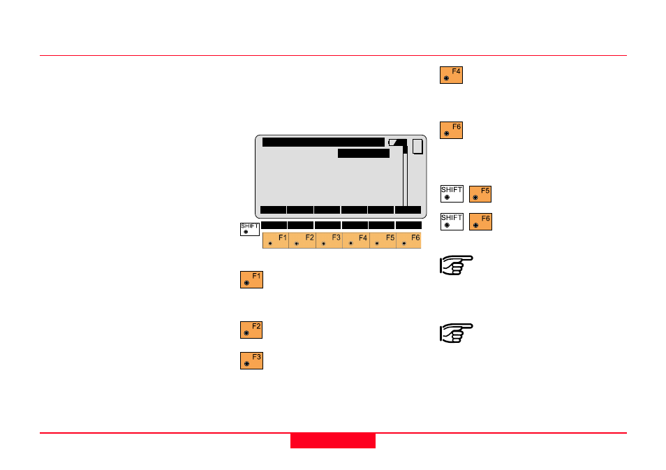
Define Points
This dialog defines the points that
determine the plane. Up to 10 points
can be used. They can be measured
or imported from a file.
Simultaneously measure and
record data in the Meas job.
Continue to next point.
Measure a distance.
Record the measurement in
the measurement job.
REFP\ Def Local Plane Pt.1
Point Id
:
1
Refl. Ht. :
0.000 m
Hz :
364.3931 g
V :
98.2225 g
Horiz.Dist:
256.114 m
Elev.Diff.: 12.004 m
MC
ALL
DIST
REC
CONT
CALC
IMPOR QUIT