Compare results – Leica Geosystems TPS1100 Professional Series - Reference Manual User Manual
Page 25
25
TPS1100 - Appl. Prog. Ref. Manual 2.2.0en
Resection
Compare results
The comparison function compares
the station coordinates and the
orientation calculated by the program
to the station coordinates and the
orientation currently set in the
instrument.
∆∆∆∆∆
Ori
Orientation difference between the
calculated orientation and the
orientation set in the instrument.
∆∆∆∆∆
East
Difference between the calculated
Easting of the station and the Easting
set in the intrument.
(Calc. East - Fix East)
∆∆∆∆∆
North
Difference between the calculated
Northing of the station and the
Northing set in the intrument.
(Calc.North - Fix North)
∆∆∆∆∆
Ht.
Difference between the calculated
Elevation of the station and the
Elevation set in the intrument.
(Calc.Elev. - Fix Elev.)
Fix East
Easting coordinate of the station
currently set in the intrument.
Return to the results dialog.
Fix North
Northing coordinate of the station
currently set in the intrument.
Fix Elev.
Elevation of the station currently set
in the intrument.
Calc. East
Easting coordinate of the station
calculated with resection.
Calc.North
Northing coordinate of the station
calculated with resection.
Calc.Elev.
Elevation of the station calculated
with resection.
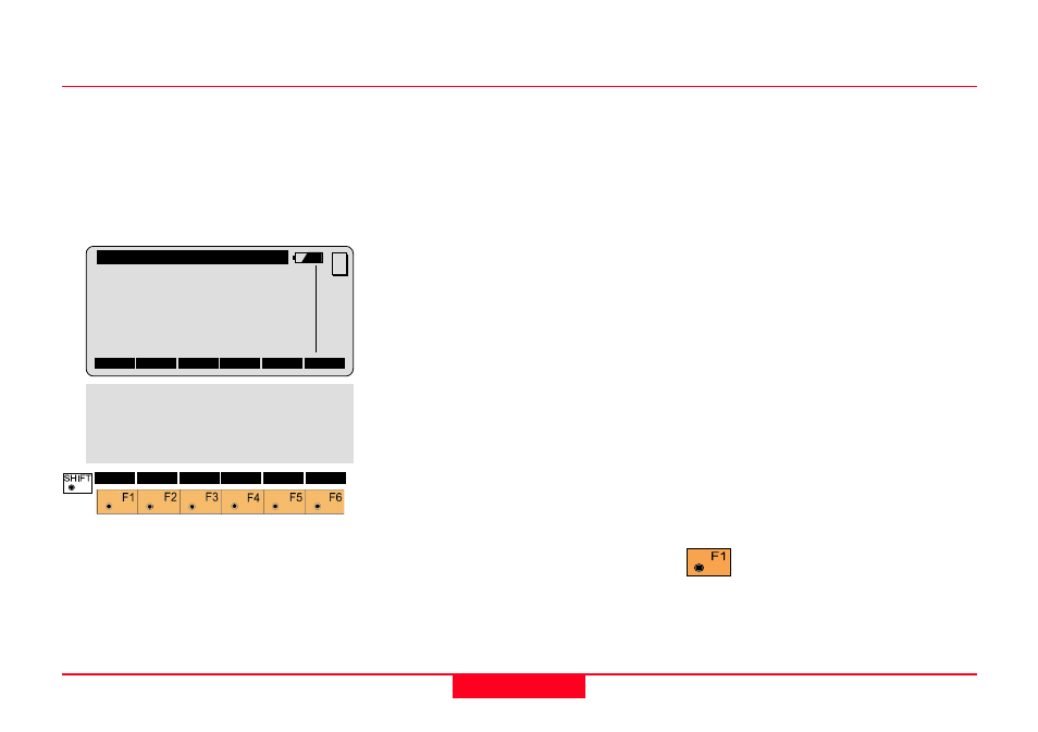
Resec\ Compare Results
Station Id:
1
∆∆∆∆∆
Ori.
:
0°00'05"
∆∆∆∆∆
East
:
-0.002 m
∆∆∆∆∆
North
:
0.006 m
∆∆∆∆∆
Ht.
:
-0.020 m
Fix East
:
2134.236 m
CONT
MC
Fix North :
4231.359 m
Fix Elev. :
580.663 m
Calc.East :
2134.234 m
Calc.North:
4231.365 m
Calc.Elev.:
580.643 m
QUIT