Orthogonal stakeout, Stakeout – Leica Geosystems TPS1100 Professional Series - Reference Manual User Manual
Page 44
44
TPS1100 - Appl. Prog. Ref. Manual 2.2.0en
Stakeout
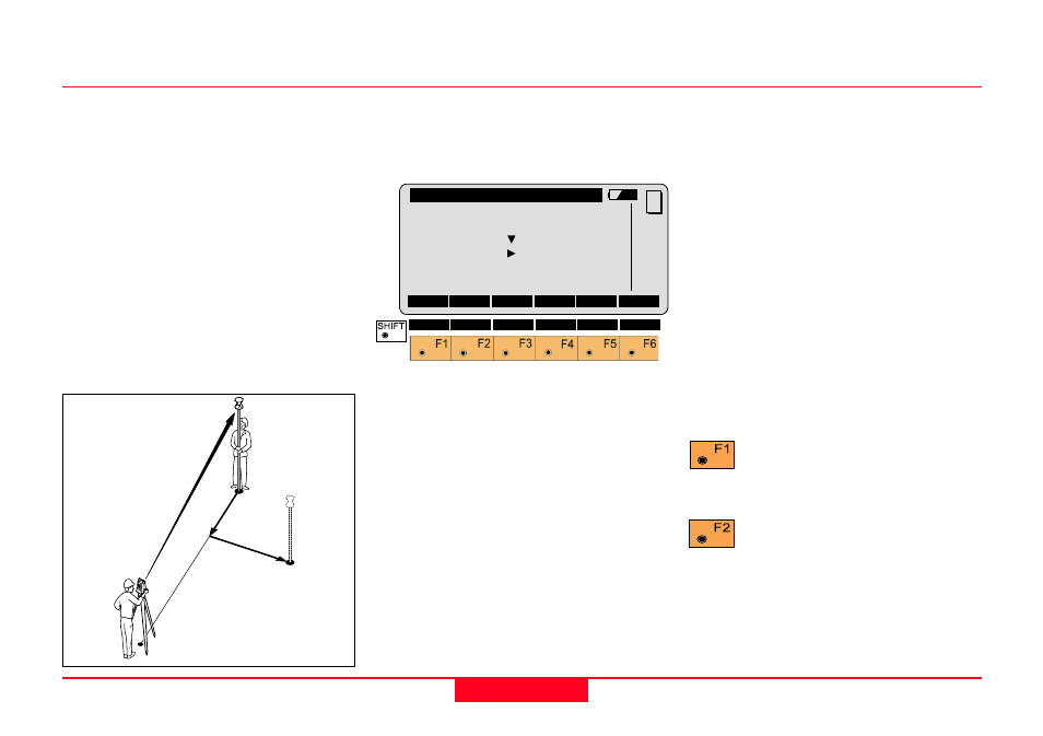
Orthogonal Stakeout
Orthogonal offsets are computed
using the baseline between the last
measured point and the instrument
station.
After the first distance measurement,
the transverse and longitudinal
differences are displayed. If the
elevation of the stakeout point is
available, the height difference
between the measured reflector and
the point to be staked is shown, and
also the measured elevation of the
reflector point.
Values for
∆
Cross and
∆
Length will
be updated each time a new distance
is measured.
Point Id
Point Id of the point to be staked.
Refl. Ht
Reflector height used at target point.
∆
∆
∆
∆
∆
Cross
Transversal displacement of the
reflector. Positive in sign if point is
right.
∆∆∆∆∆
Length
Longitudinal displacement of the
reflector. Positive in sign if stakeout
point is further away from station.
∆∆∆∆∆
Height
Difference in height between
measured reflector point and the
stakeout point. Positive in sign if
stakeout point is higher than the
reflector position.
Elevation
Elevation of the measured reflector
point.
Simultaneously measure and
record data in the
measurement job.
Measure a distance.
STAKE\ Orthogonal
Point Id
:
12
Refl. Ht. :
1.65 m
∆∆∆∆∆
Cross
:
1.430 m
∆∆∆∆∆
Length
:
-1.550 m
∆∆∆∆∆
Height
:FILL
0.982 m
Elevation :
0.750 m
ALL
DIST
REC
CONT
POSIT
MC
METHD
PLOT
QUIT
1
100pr1
1
12
∆
Cross+
∆
Length –