Results, Tie distance results – Leica Geosystems TPS1100 Professional Series - Reference Manual User Manual
Page 32
32
TPS1100 - Appl. Prog. Ref. Manual 2.2.0en
Tie Distance
Results
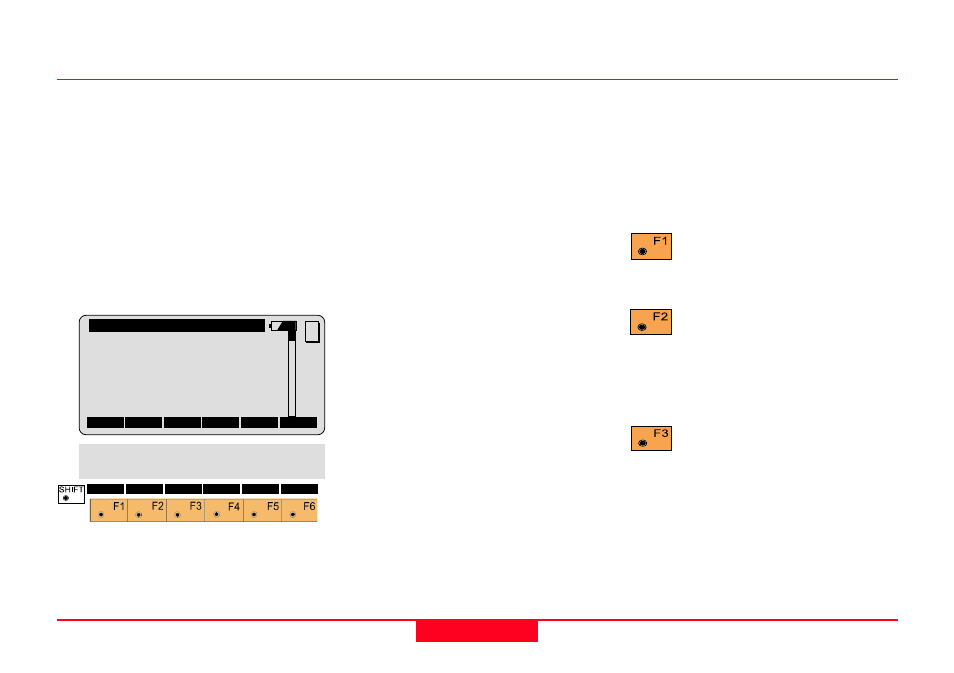
This dialog shows the results
computed from the last two points,
which can be measured or retrieved
from the active file. The same results
are calculated for both methods.
Using "Polygon Mode" the
calculations are always based on the
last two points, where as the "Radial
Mode" always uses the first point as
a reference point.
Center Pt.
Point number of the center point
Radial Pt.
Point number of the radial point
Hori.Dist
Horizontal distance between the two
points
Azimuth
Azimuth from point 1 to point 2
∆
∆
∆
∆
∆
Height
Height difference between point 1
and point 2 (H2 - H1).
Slope Dist
Slope distance between the two
points.
∆
∆
∆
∆
∆
East
Difference in Easting between point 1
and point 2 (E2 - E1).
The grid coordinates are only valid
for oriented instruments set up on a
known point.
∆∆∆∆∆
North
Difference Northing between point 1
and point 2 (N2 - N1).
Note, the grid coordinates are only
relevant for oriented instruments set
up on a known point.
Return to the dialog "NEXT
POINT" and measure the
next point.
Delete previous inputs.
Proceed with the dialog
"FIRST POINT" to enter a new
reference point. This function is
available for "RADIAL MODE" only.
Record the following results
in the active measurement
job:
WI 11
Point number of point 2 or
radial point number
WI 25
Azimuth from point1 to point 2
WI 35
Horizontal distance
QUIT
∆
∆
∆
∆
∆
East
:
22.432
∆
∆
∆
∆
∆
North
:
50.083
TieD\ Radial Mode
Center Pt :
12
Radial Pt :
13
Hori.Dist :
4.567
Azimuth
:
342°52'35''
∆
∆
∆
∆
∆
Height
:
2.543
Slope Dist:
4.946
NEXT RESET STORE
POLY
MC