Bearing-distance intersection, Cogo – Leica Geosystems TPS1100 Professional Series - Reference Manual User Manual
Page 154
154
TPS1100 - Appl. Prog. Ref. Manual 2.2.0en
COGO
Return to
"INTERSECTIONS".
The following results have
been stored in the active
measurement data file:
WI 11 Station Point Number
WI 81 Easting coordinate
WI 82 Northing coordinate
WI 83 Elevation (optional)
If "Point Id" has not been entered, the
function is not available.
Call up the program
"Stakeout".
The program "Stakeout" assumes
that the instrument is set and
oriented to a known point.
If "Point Id" has not been entered, the
function is not available.
Exit the program.
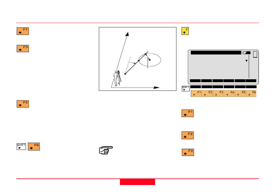
Bearing-Distance Intersection
Search
• Bearing-bearing coordinates
S1 and S2 (E, N)
Given
• point 1 (E, N), direction
(magnetic bearing or azimuth)
• point 2 (E, N), radius
Station coordinates and
orientation need to have
been set correctly before the
coordinates of point 1 (and/or 2) can
be determined by measurement.
Call up the function "Bearing-
Distance" from the menu
"INTERSECTIONS".
Search for the coordinates of
the first point (or circle centre
point) in the datajob.
Measuring the first point (or
circle centre point).
Manual entering of the first
point (or circle centre point).
Bearing-Bearing Intersection, continued
COGO\
Bearing From
Data Job
: FILE02.GSI A:
Search for:
PointId+E+N
PointId
:
58
SEARC MEAS INPUT
VIEW
MC
1
100pr70
N
E
2
1
Azimuth #1
Horiz.Dist.
I
2
I
1