Road – Leica Geosystems TPS1100 Professional Series - Reference Manual User Manual
Page 205
205
TPS1100 - Appl. Prog. Ref. Manual 2.2.0en
Road+
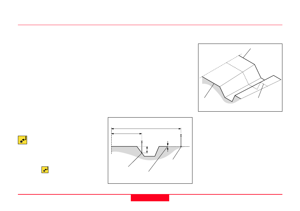
• Cross Section Interpolation
Cross sections can be interpolated
both along the cross section (i.e.
between defined points), and
between cross sections themselves.
The interpolation between cross
sections makes superelevation and
widening possible. The following
diagrams illustrate these concepts.
Interpolation between cross sections:
Interpolation along a cross section:
RPLUS03
CL offset
CL offset
∆
H
∆
H
Interpolated point
Last point
on Xsec
Interpolated
point (horizontal)
RPLUS04
Cross Section B
(with widening)
3.00
3.50
Cross
Section A
Interpolated
Cross Section
CL
100
130
150
CL
When CRS Intrpl is set to ON, this
same data would be treated
differently, assuming all three cross
section templates have the same
number of points in them.
Road+ would start with XSEC1 at
station (chainage) 0+00, and
transition linearly to XSEC2 at station
1+00. Then it would transition linearly
to XSEC3 at station (chainage) 3+00,
and finally transition linearly back to
XSEC1 at station (chainage) 5+50.
If the project continues past station
(chainage) 5+50, XSEC1 will be
applied.
Cross Section Assignment File, continued
Select the cross section
assignment file. A dialog box
appears with a list of all
STA?????.GSI files available.
Move the cursor to the file needed
and press
.