DAVIS FMS 3.9.3 DriveRight (8186) User Manual
Page 78
DriveRight FMS User's manual
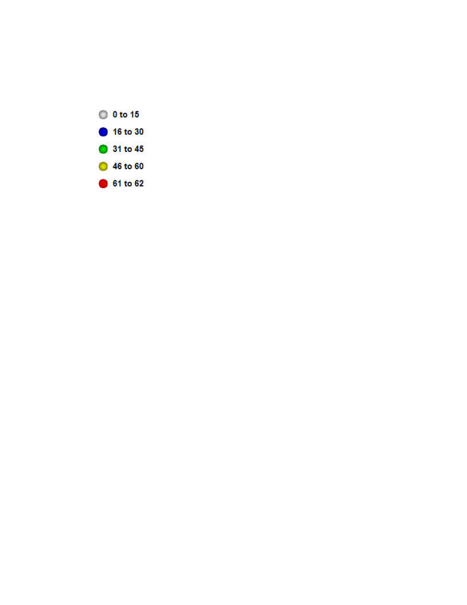
Round pushpins indicate the GPS plot points in a trip.
The different colored round pushpins indicate different vehicle speeds at different GPS
plot points, as shown in the legend of map symbols (below).
For more detailed instructions on all of the controls and features of Google Maps, go to Basics -
The Google Maps User Guide at:
http://maps.google.com/support/bin/answer.py?hl=en&answer=68259.
If you are using Google Earth as your mapping tool, a Trip Map includes the following key
elements (click any heading to display more detail):
Navigation Controls
Use this tool to navigate left, right, up, or down, or to zoom in or out in the Google Earth window.
You can also click and drag anywhere on the 3D map to move it in any direction, or use your
keyboard's up, down, left, or right arrows to move north, south, east, or west, respectively.
Because the Google Earth map is a 3D image, when you "pan" in any direction, you are
presented with an image that simulates that you are rotating on the Earth's axis.
A detailed explanation of how to use the "North-up" button, the Look and Move joysticks, and the
Zoom slider are listed below the image.
66