Chapter 4 - operation 108 – TeeJet Legacy 6000 Manual User Manual
Page 113
Chapter 4 - operation
108
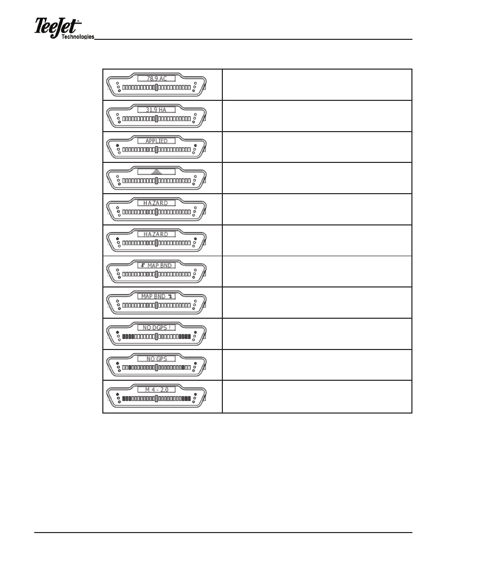
Area Applied A user-defined message indicating the current amount of
area applied in acres. System unit set to uS.
Area Applied A user-defined message indicating the amount of area
applied in hectares. System unit set to metric.
applied area detection this message is displayed when the vehicle is
in a previously applied area. the red stoplights are illuminated and an
alarm will sound.
Curved guidance information graphics. the four horizontal bars rep-
resent a perspective view of the swath ahead of the vehicle. the bars
skew left or right to represent a curved path ahead.
hazard detection the name of the hazard is displayed when the
vehicle is approaching an existing hazard. the yellow stoplights are
illuminated indicating an initial warning.
hazard detection the name of the hazard is displayed when the
vehicle is approaching an existing hazard. the Red stop lights are
illuminated indicating the final warning.
mapping Boundary this message is displayed when the user is map-
ping a field boundary. The arrow symbol indicates the field boundary is
on the left side of the vehicle.
mapping Boundary this message is displayed when the user is map-
ping a field boundary. The arrow symbol indicates the field boundary is
on the right side of the vehicle.
System warning the message is displayed when there is loss of gPS
differential corrections. guidance calculations are stopped until differen-
tial corrections resume. gPS type is set to dgPS.
System warning this message is displayed when there is a complete
loss of gPS signal to the gPS receiver. guidance calculations are
stopped until dgPS signal resumes. gPS type is set to dgPS.
Lightbar Version message this message is displayed when the user
runs the Lightbar test. m 4 indicates lightbar model and 2.0 indicates
lightbar protocol version number. this number varies based on lightbar
version and model.