Tilt zero initial direction – Ag Leader GeoSteer Operation Manual User Manual
Page 70
Auto Calibrate
56
GeoSteer System
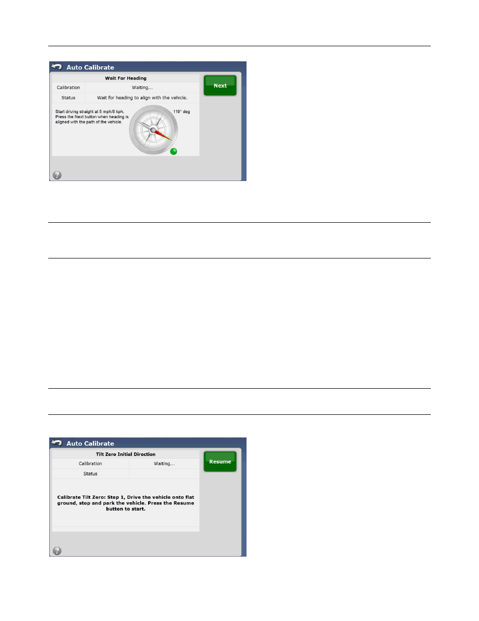
Figure 2-53 Waiting for Heading
Start driving in a straight line at 5 mph (8 k/h). Observe the red needle and green shaded area. Both should line up within a few
seconds. If they both line up, press the Next button to continue.
Note: If the red needle and the green shaded area do not line up after the compass calibration, verify that the GeoSteer Control
Unit has been set to the correct orientation. If the orientation has been set incorrectly, the GeoSteer system will not be able to
accurately determine a heading. Restart the calibration.
Tilt Zero Initial Direction
The GeoSteer uses its sensors to determine the tilt of the vehicle as it travels through the field. This is important to allow the
system to calculate the true position of the wheels if the cab is tilting to one side or another. The GPS is mounted on top of the
cab so even though the GPS may move as the cab moves, the wheels will still be in the same place. If the tilt of the vehicle is
not accurately measured, the system will not be able to control the vehicle accurately.
The Tilt calibration is a two step process. The vehicle must be parked on a flat area and left to sit. The system then averages the
sensor readings for a short time to get a base line. The vehicle must then be driven and turned around to face the opposite
direction and stopped at the exact same spot. The system then averages the sensor reading while faced in the other direction.
The system is then able to use the two readings to zero out the slight tilt errors of the gyros.
Note: It is important that the Tilt Calibration takes place on a flat area with no slope. If this step is performed on a slope, the
GeoSteer system may not be able to accurately control the vehicle.
Figure 2-54 Tilt Zero Initial Direction Calibration