General, Satellite tracking – Ag Leader GeoSteer Operation Manual User Manual
Page 137
GPS
Diagnostics
Operator’s
Manual
123
General
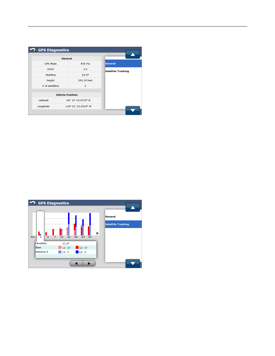
Figure 4-48 GPS Diagnostics General
The General screen displays the status of a number of operations parameters are explained below:
• GPS Mode – The current GPS mode the system is operating in.
• PDOP – (Positional Dilution of Precision) is a measure of the strength of the satellites scatter. When the satellites are close
together, their geometry is not favorable for position calculations and the PDOP value is high; when their geometry is
favorable and they are far apart, the PDOP value is low. Thus a low PDOP value represents a better GPS positional
accuracy.
• Heading – Displays the heading the vehicle is facing or traveling in degrees.
• Height – Shows the Vehicle’s altitude above sea level.
• # of satellites – Displays the number of satellites being tracked by the system
• Vehicle Position – Vehicle position in latitude and longitude.
Satellite Tracking
Figure 4-49 GPS Diagnostics Sat Tracking
The Satellite Tracking screen displays the status of the tracked satellites from the Base Station and the GeoSteer. The screen is
refreshed at 1Hz. Each satellite tracked has a unique PRN that is used to identify it. The signal strength for each PRN is shown
on the graph. The higher the bar, the higher the signal strength which in turn means it is easier for the GeoSteer to use that data
for position calculations. The screen displays the Signal to Noise Ratio (SNR) depicted in a bar graph format. The graph shows
data for each satellite being tracked on L1 and L2 for both the Base Station and the GeoSteer.