Gps diagnostics, Forecast – Ag Leader GeoSteer Operation Manual User Manual
Page 136
GPS Diagnostics
122
GeoSteer System
Satellites in circles are GPS and Satellites in a square box are GLONASS. The numbers on them represent each satellite’s
PRN.
Note: GLONASS is a satellite Navigation System operated by the Russian Government. It is an alternative and complementary
system to the US Global Positioning System. Tracking GLONASS satellites may help maintain a valid position, in challenging
environments.
GLONASS tracking with GeoSteer requires a Feature Code to unlock it.
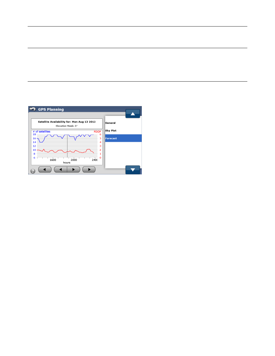
Forecast
Figure 4-47 Satellite Forecast
The Forecast screen shows satellite availability for a specific date and time. Use the Outer Gray Left and Right Arrow buttons
to change the date shown. Use the Inner Gray Left and Right Arrow buttons to change the hours of interest
The blue line represents the number of satellites through out the time period shown. The red line represents the PDOP over the
time period shown. Higher satellites counts are better and lower PDOP values are better. Use this graph to determine times of
high PDOP where accuracy could suffer. If accuracy is critical, plan around poor satellite availability.
GPS Diagnostics
The GPS Diagnostics screen provides information about the quality of the GPS signals. The information provided can help to
troubleshoot GPS problems. There are two options available in the GPS Diagnostics screen:
• General – This section provides the basic information about the GPS data.
• Satellite Tracking – This section provides the satellite signal strength for both the GeoSteer and the Base Station. The data
can be compared to see what satellites are common and if there are any problems with the satellite signals.
To access GPS Diagnostics screen, press the GPS Diagnostics button from the GPS screen.