Boundary – TeeJet Swath XL User Manual
Page 78
Chapter 3 - Real-Time Guidance
3-30
Data Setup
Swath XL
Software Version 3.00
Boundary
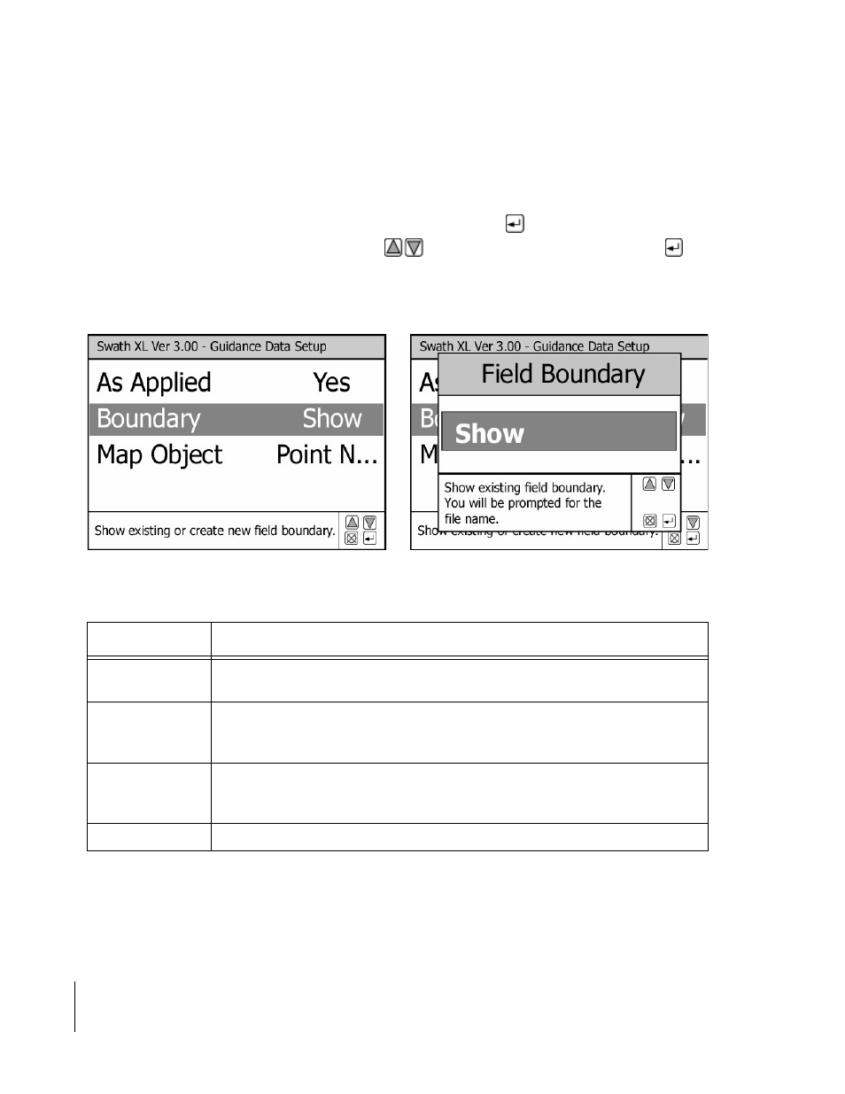
The Boundary menu item allows you to indicate whether you want to Show or create a field boundary. An existing
boundary can be displayed in the background of the guidance view page. Field boundaries can also be created while
applying product to the headland area of a field, see Table 3-10.
To change the Boundary setting, highlight the Boundary menu item and press
. The Field Boundary dialog box
appears. Select the desired setting using the arrow keys
. Once the desired setting is selected, press
to
return to the Data setup menu, see Figure 3-35.
Figure 3-35: The Boundary Menu Item
Setting
Description
Show
Displays an existing field boundary in the guidance map page. You are prompted for
the existing boundary file name.
Create on Right
The field boundary is created based on the position of the right edge of the swath. The
edge of the swath is determined by the swath width. You are prompted for a new
boundary file name.
Create on Left
The field boundary is created based on the position of the left edge of the swath. The
edge of the swath is determined by the swath width. You are prompted for a new
boundary file name.
Off
No boundary is created or shown.
Table 3-12: The Boundary Menu Item Settings