Marking a hazard – TeeJet Swath XL User Manual
Page 113
Swath XL
Software Version 3.00
3-65
Chapter 3 - Real-Time Guidance
Mapping Points and Hazards
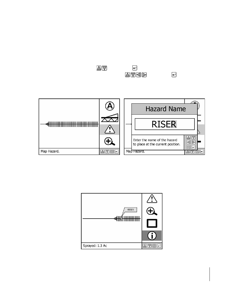
Marking a Hazard
The map object Hazard allows you to mark a hazard at the vehicle location. The map object Hazard can be used later
in Hazard Detection, page 3-67, to notify the operator of potentially hazardous objects or features within the field.
Hazard detection does not work with point objects. When Swath XL is setup to map a hazard, a hazard button is
added to the view page button bar, see Figure 3-88 (left side). To map a hazard drive to the location of the object or
feature you want to map. This location should coincide with the location of your GPS antenna. Next, highlight the
Hazard button in the button bar using the
keys then press
. The Hazard Name dialog box appears, see Fig-
ure 3-88 (right side). Enter the name of the hazard using the
keys. Press the
to accept the hazard
name and return to the real-time view page, Figure 3-89.
Figure 3-89 shows a mapped hazard with the tag showing the hazard name RISER. The tag is displayed when the
Information button in the button bar is highlighted or activated.
Figure 3-88: Mapping and Naming a Hazard
Figure 3-89: Marked Hazard in the View Page