Navigating to points – TeeJet Swath XL User Manual
Page 152
Chapter 4 - Waypoint Navigation
4-32
Nav 2 Point Real-Time Scenarios
Swath XL
Software Version 3.00
Navigating to Points
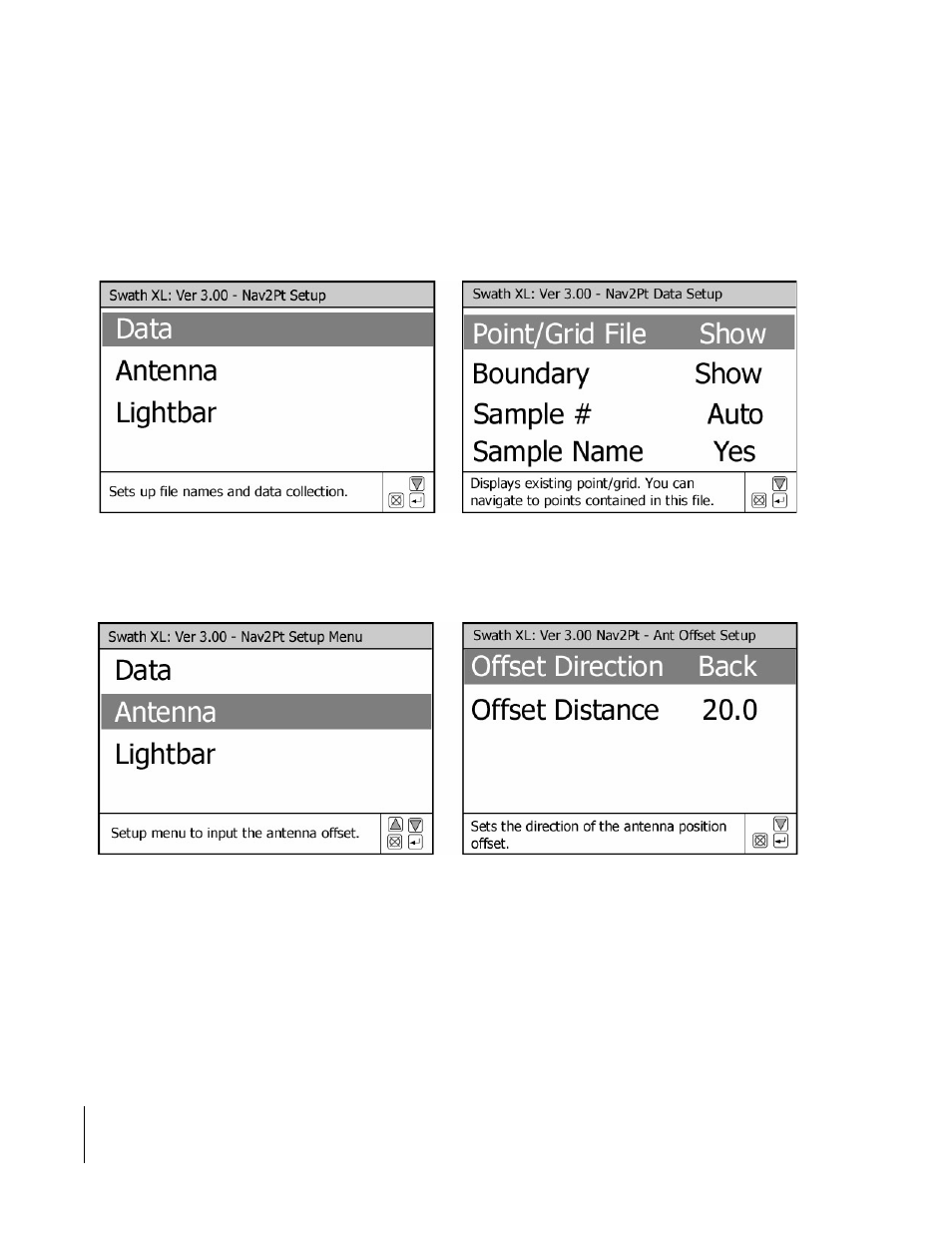
In this example the operator is displaying a Point/Grid file that contains a set of points the operator wants to navigate
to. The Data Setup menu, Figure 4 -37, shows how the operator has configured Nav 2 Point. Because the Point/Grid
file exists the operator only needs to select Show. As in the previous example, the operator also wants to offset the
antenna to position it over the soil probe located on the back of the pick-up truck, see Figure 4 -38.
Once the setup process is completed and the operator has selected Start Nav 2 Point they are presented with the Start
Nav 2 Point page shown in Figure 4 -39 and Figure 4 -40. In this example the operator must select the existing Point/
Grid file and the existing Boundary file. Lastly the operator must enter the starting sample point number, Figure 4 -
41. After the operator has selected the appropriate file names and entered the starting sample point number, they must
select and press the GO menu item. This brings them to the real-time view page, Figure 4 -42.
Figure 4-37: Data Setup Menu
Figure 4-38: Setting Up an Antenna Offset