Gll: geographic position - latitude/longitude, Function, Command format – Spectra Precision ProMark 800 Reference Manual User Manual
Page 314: Response format, Example
302
Query Command Library
As an example, the command below will output GGA
messages on port A at a rate of 0.5 second:
$PASHS,NME,GGA,A,ON,0.5
GLL: Geographic Position - Latitude/Longitude
Function
This command is used to output a GLL message containing
the last computed position. The message is output on the port
on which the query is made. If no position is computed, the
message will be output anyway, but all position-related fields
will be blank.
Command Format
Syntax
$PASHQ,GLL[*cc]
Response Format
Syntax
$GPGLL,m1,c2,m3,c4,m5,c6,c7*cc
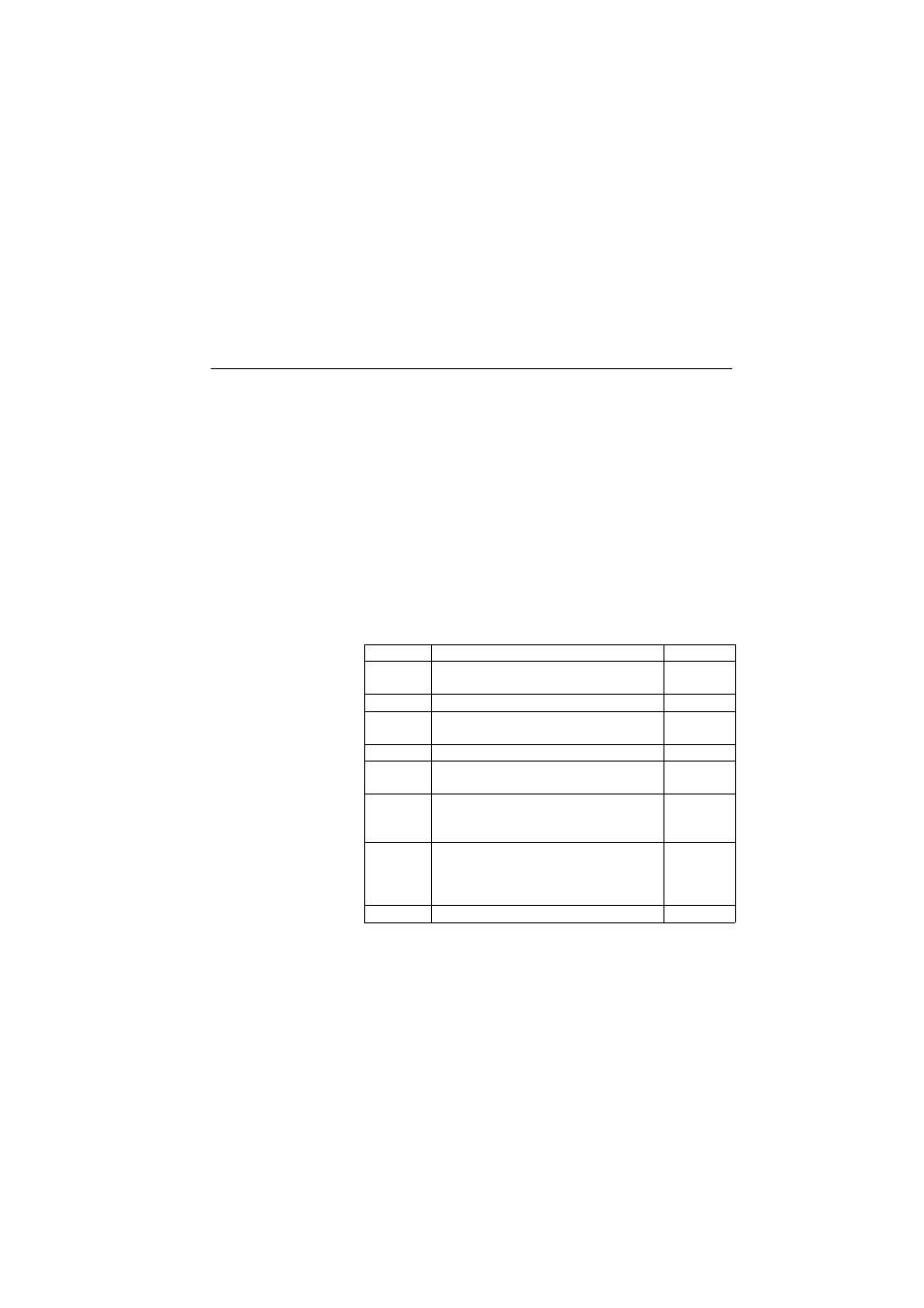
Parameters
Example
$PASHQ,GLL
$GPGLL,4717.960853,N,00130.499473,W,132331.00,A,D*7D
Parameter
Description
Range
m1
Latitude of position (ddmm.mmmmmm)
0-90
0-59.999999
c2
Direction of latitude
N, S
m3
Longitude of position (dddmm.mmmmmm)
0-180
0-59.999999
c4
Direction of longitude
E,W
m5
Current UTC time of position (hhmmss.ss)
000000.00-
235959.99
c6
Status
• A: Data valid
• V: Data not valid
A, V
c7
Mode indicator:
• A: Autonomous mode
• D: Differential mode
• N: Data not valid
A, D, N
*cc
Checksum
*00-*FF