Leica Geosystems Leica mojo3D - User Manual User Manual
Page 166
166
Leica mojo3D, Field Boundary
Exporting Google
Earth and Shapefile
data for a selected
boundary, step-by-
step
To export Google Earth and Shapefile data for a selected field boundary, carry out
the following steps:
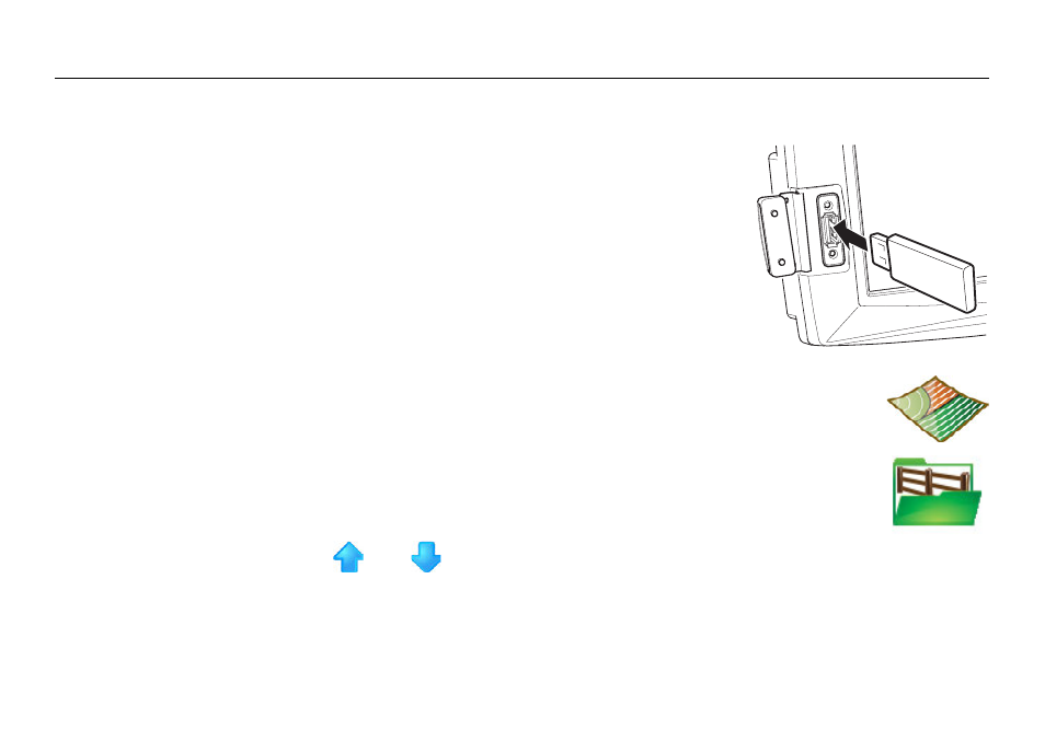
1. The USB interface is on the lower left front of the
mojo3D display. Lift the rubber cover and insert a
compatible USB Flash Drive into the USB slot.
2. On the main navigation screen, tap the mapping button.
3. On the flyout menu, tap the boundary management button.
The Field Management screen displays.
4. Tap
and
to scroll though the list of field boundaries. To
select the field boundary to export, tap the boundary name.
mojo3D_010
See also other documents in the category Leica Geosystems Equipment:
- Laser class 2 products - Safety Manual (32 pages)
- Leica DISTO transfer - How to connect (34 pages)
- DISTO + Bluetooth – getting started on Android (24 pages)
- DISTO + Bluetooth – getting started on Windows 8 (24 pages)
- DISTO + Bluetooth – getting started on iOS (27 pages)
- Roteo 20HV, 25H, 35, 35G (31 pages)
- Laser class 3R products - Safety Manual (32 pages)
- Leica 3D Disto - Manual (219 pages)
- GWCL60 (4 pages)
- GKL211 (6 pages)
- GKL112 (6 pages)
- SNLL121 (28 pages)
- Basic Laser Plummet (32 pages)
- GHM007 (2 pages)
- Bluetooth (2 pages)
- FieldGear (6 pages)
- GKL32 (6 pages)
- DIGICAT 500i/550i Safety Guide (186 pages)
- Leica DISTO A2 (10 pages)
- Leica DISTO Classic3 (64 pages)
- Leica DISTO Classic5 (18 pages)
- Leica DISTO D110 – Manual (13 pages)
- Leica DISTO D2 (16 pages)
- Leica DISTO D210 - Manual (14 pages)
- Leica DISTO D3 (26 pages)
- Leica DISTO D3a - Quickstart (2 pages)
- Leica DISTO D3a - User Manual (24 pages)
- Leica DISTO D3a BT (25 pages)
- Leica DISTO D410 - Manual (24 pages)
- Leica DISTO D410 - Quickstart (2 pages)
- Leica DISTO D5 (24 pages)
- Leica DISTO D510 - Quickstart (2 pages)
- Leica DISTO D510 - Manual (31 pages)
- Leica DISTO D8 (24 pages)
- Leica DISTO D810 touch - Quickstart (2 pages)
- Leica DISTO D810 touch - Manual (44 pages)
- Leica DISTO DXT (16 pages)
- Leica DISTO E7300 (14 pages)
- Leica DISTO E7400x (22 pages)
- Leica DISTO E7500i - Quickstart (2 pages)
- Leica DISTO E7500i - Manual (32 pages)
- Leica DISTO lite5 (12 pages)
- Leica DISTO plus - Manual (16 pages)
- PlusDraw (19 pages)
- PlusXL (15 pages)