A note about projections and, Datums, What is a map projection – Google Earth User Guide User Manual
Page 98: A note about projections, And datums, A brief discussion of projections and datums
●
Save the imagery overlay as a KMZ file - If you wish to remove the imported imagery from your My
Places folder, you can right-click (CTRL click on the Mac) on the item and select Save As... from the
pop-up menu and save the GIS overlay as a KMZ file to your computer's hard drive or other accessible
file location. After that, you can delete the overlay from your My Places list and open it later when you
need it.
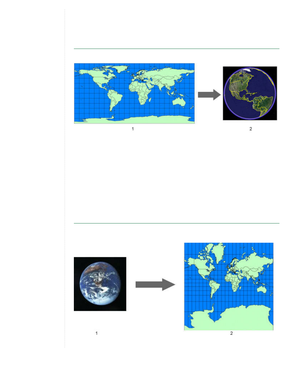
A Note About Projections and Datums
Google Earth uses Simple Cylindrical projection with a WGS84 datum for its imagery base.
1. Simple Cylindrical (Plate Carree) Projection
2. Google Earth Image Base
Typically, the data you import into the Google Earth application is created with a specific geographic
coordinate system, such as a Universal Transverse Mercator (UTM) projection and a NAD27 datum (North
American Datum of 1927). Each geographic coordinate system may assign slightly different coordinates to the
same location on the earth. When you import data into Google Earth, your data is interpreted according to the
Google Earth coordinate system.
In the majority of cases, reprojection works as expected. In some situations, the transformation might not work
properly. In that case, you can use a third-party tool to transform your data from its original coordinate system
into the one used by Google Earth.
The rest of this section provides a brief overview of map projections and datums.
What is a Map Projection?
A map projection is a mathematical expression that is used to represent the round, 3D surface of the earth on
a flat, 2D map.
1. 3D Earth