3d viewer options - google earth user guide, 3d viewer options, Displaying a lat/lon grid – Google Earth User Guide User Manual
Page 124: Grid, Google earth user guide
Google Earth User Guide
●
3D Viewer Options
❍
■
■
3D Viewer Options
Some of the features described in this section are only available to users of the Google Earth EC product.
Google Earth provides a number of 3D viewer settings that you can modify, as well as features you can
activate for special 3D display. These include:
Display a lat/lon grid over the 3D viewer
Toggle between full-screen and window mode
Set the view size of the 3D viewer to specific ratios
Use the Overview window for additional perspective
Modify view settings to suit your preferences
Memory and Disk Cache Preferences
To show or hide the 3D viewer toolbar, click Tools > Toolbar.
Displaying a Lat/Lon Grid
Google Earth provides a special layer accessible from the View menu that displays a grid of latitude and
longitude lines over the imagery in the 3D viewer. To turn on the grid do one of the following:
●
Select View > Lat/Lon Grid.
●
Type Ctrl + L (
+ L on the Mac)
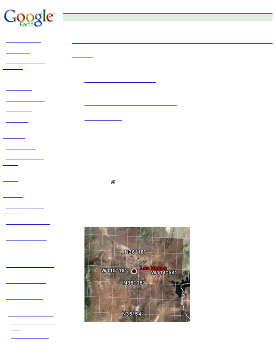
The grid appears over the earth imagery as white lines, with each latitude/longitude degree line labeled
in an axis across the center of the 3D viewer. You can position a geographical feature in the 3D viewer
and determine its basic geo-spatial coordinates using this grid.
As you zoom in, the level of detail of the degree lines increases. For example, from an eye elevation of
about 100 miles, Las Vegas, Nevada, appears north of the 36th parallel, and just west of the 115th
meridian.
As you zoom to an eye altitude of just above 2000 feet, you can see that the marker for Las Vegas,
Nevada, sits at W115 08'11" and N36 10'29".