Using layers - google earth user guide, Using layers, Use this to display points of interest – Google Earth User Guide User Manual
Page 31: Google earth user guide, Layers versus places
Google Earth User Guide
●
Using Layers
■
Locating POIs in Your
Viewing Area
■
Saving or Copying POIs
to My Places
■
■
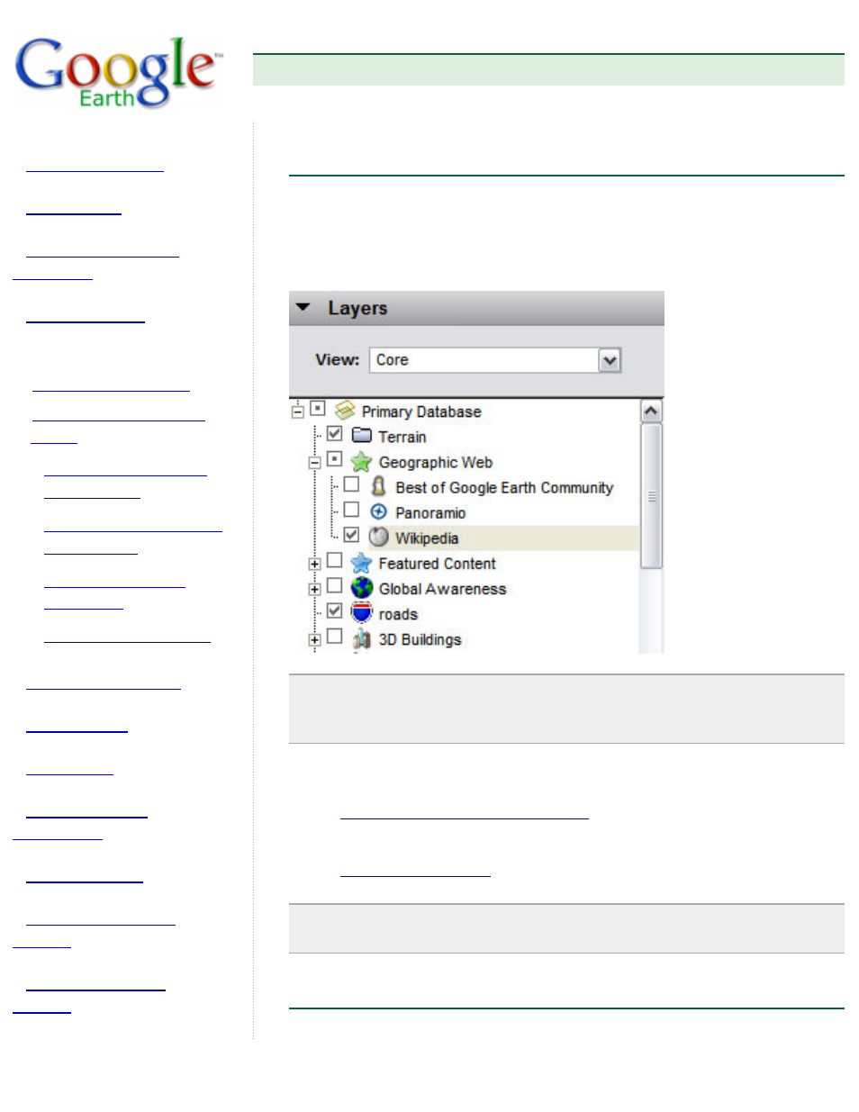
Using Layers
The Layers feature in Google Earth provides a variety of data points of
geographic interest that you can select to display over your viewing area.
This includes points of interest (POIs) as well as map, road, terrain, and
even building data. The full list of layers is available in the Layers panel:
Note: In the View field, you can choose to display all available layers (All
Layers), key layers (Core) or just those that are currently displayed (Now
Enabled).
You can use the layer data feature of Google Earth to:
Display and save points of interest
●
Display map features such as borders, roads, and terrain
Tip: You can display or hide country, state or province borders by
checking or unchecking Borders in the Layers panel.
Layers Versus Places