Measuring distances and areas, Measuring distances, And areas – Google Earth User Guide User Manual
Page 71: Measure a distance or area size, Google earth user guide
Google Earth User Guide
●
●
●
●
●
●
●
●
●
●
●
●
●
Measuring Distances and
Areas
●
●
●
Measuring Distances and Areas
Google Earth offers a number of tools that you can use to measure distances and
estimate sizes. Depending upon which version of Google Earth you are using, you
have access to the following measuring tools:
●
Measuring with a line or path (all Google Earth versions)
●
Measuring with a circle radius or polygon (Google Earth PRO)
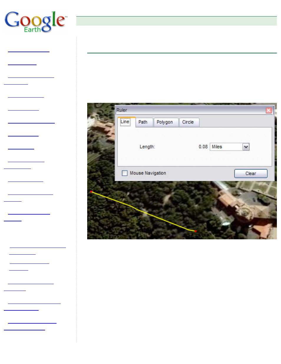
Use the Ruler window (Tools menu) to measure length, area, and circumference as
follows:
1. Position the imagery you want to measure within the 3D viewer and make sure
you are viewing the earth from top-down (type U) and with terrain turned off for
best accuracy. Measuring is calculated using the lat/lon coordinates from point
to point and does not consider elevation.
2. From the Tools menu, select Ruler. The Ruler dialog box appears. Consider
moving the dialog box to a region of your screen that doesn't obstruct the 3D
viewer.
3. Choose the type of shape you want to measure with. All versions of Google
Earth can measure with Line or Path. Google Earth PRO users can also
measure using a polygon or circle.
4. Choose the unit of measure for length, perimeter, area, radius, or
circumference, as applicable. See the table below for a list of supported units